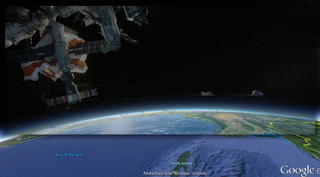
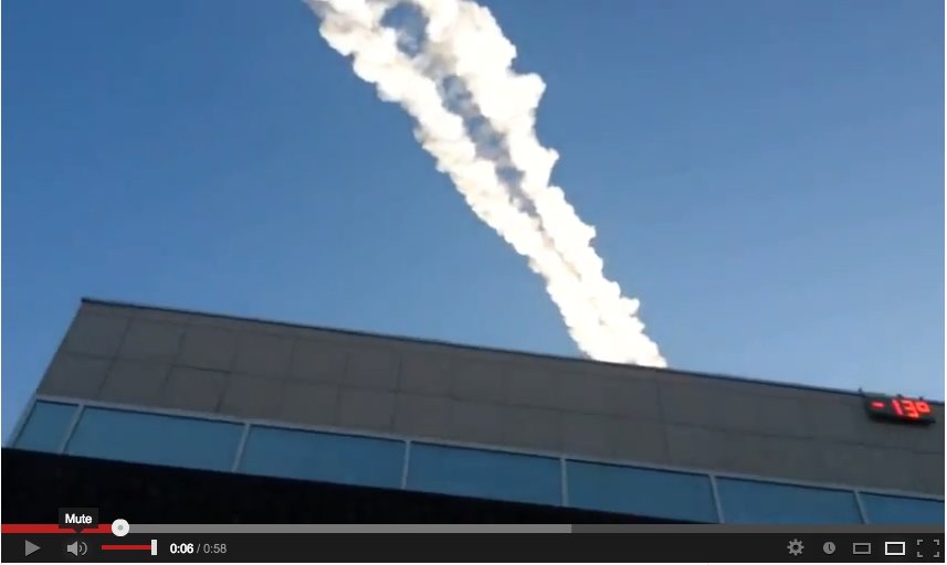
(TL;DR VERSION: I’ve managed to match the views of Earth in “Gravity” with equivalent views in Google Earth to reconstruct the orbital path of the astronauts. Here’s the resulting KMZ file (8.8 MB) to open in Google Earth, containing all 62 georeferenced screenshots from the movie. Double-click each one to “fly into” the shot.)
The first time I saw Gravity in the cinema, the emotive kick was too great for me to pay much attention to the technical wizardry behind Alfonso Cuarón‘s modern masterpiece. So I went to see it again, this time with an eye on the film’s perennial backdrop — Earth.
I wondered: Is it possible to recognize all the places that Dr. Ryan Stone (Sandra Bullock) and Matt Kowalski (George Clooney) fly over? Is it possible to match Gravity‘s views of Earth pixel-for-pixel with the view in Google Earth? Can we use these found locations to reconstruct an orbit that matches the film’s timeline? What else can we infer from a close reading of this film’s Earth?
I resolved to find out as soon as I could get my hands on a digital copy. Admittedly, this makes for unconventional film criticism, but Gravity is an unconventional film, taking immersive realism in science fiction to a whole new level. (Mild spoilers follow, but no secrets are revealed.)
What can we conclude from placing those scenes from Gravity with an Earth backdrop in Google Earth?
- Gravity‘s daytime Earth is a highly accurate rendering. I was in almost all cases able to get a perfect match, not just for coastlines, but also for geographic features such as lakes, mountain ranges and forests. It is clear that the model they’ve used was derived from raw satellite imagery as an input, then embellished with clouds and other atmospheric effects.
- The rendering of Earth at night is geographically just as accurate, but city lights and lit roads are impressionistic rather than realistic. You can match up cities on Google Earth with those in the screenshots, but in specific cases where I am familiar with the geography (Egypt and Scandinavia) lit roads do not seem to match up with real roads, nor are city limits accurate.
- Viewing these georeferenced scenes in succession allows us to reconstruct a flight path for our protagonists. In broad strokes, we’re always orbiting in an eastwardly direction — as do the actual orbital paths of Hubble, The International Space Station (ISS), and Tiangong — though the exact path turns out to be scientifically impossible.
Geospatial plot synopsis:
Follow along with the KMZ file (8.8 MB) in Google Earth. (Numbers refer to the sequence order in the KMZ file. Play with Google Earth’s opacity slider to compare the screenshot with the view behind it.)
The very first Earth scene takes the Shuttle eastward across Mexico (#10, with a view of Mexico City, Cuarón’s birthplace) and into the Caribbean (#20-#100).
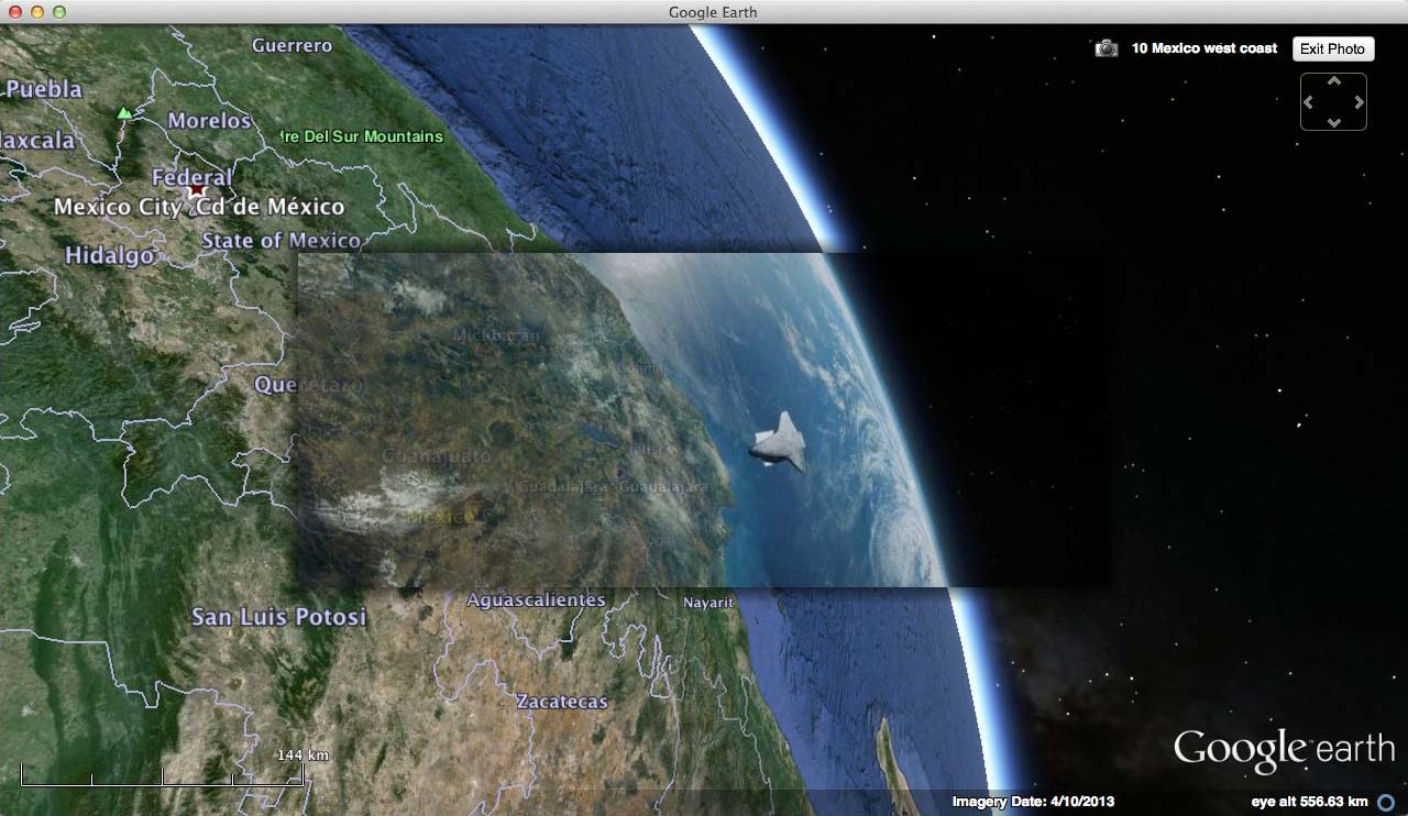
(#10)
After the Space Shuttle’s impact with space debris we turn a sharp left and head into the night along the US east coast (#110-#130), where our two astronauts are reunited. They return to the Space Shuttle over Southern Europe (#140-#200), meet the rising sun just past Egypt (#210-#230) and reach ISS over Yemen (#240-#260).
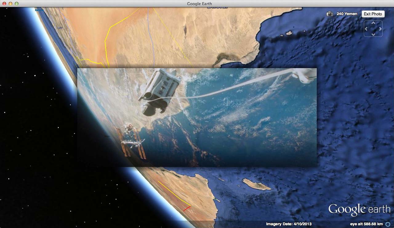
(#240)
By the time Kowalski says “You should see the sun on the Ganges” we’ve passed Sri Lanka (#270) and are crossing the Andaman Sea (#280-#320). (He can indeed see the Ganges from where we are.)
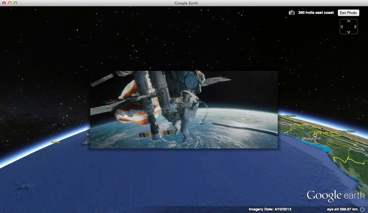
(#290)
We then again veer left, and follow the ISS across the East coast of China (#330-#350), past Japan’s west coast (#360-#370) and to the north of Sakhalin Island (#380), all while the Soyuz capsule fails to disengage from ISS.
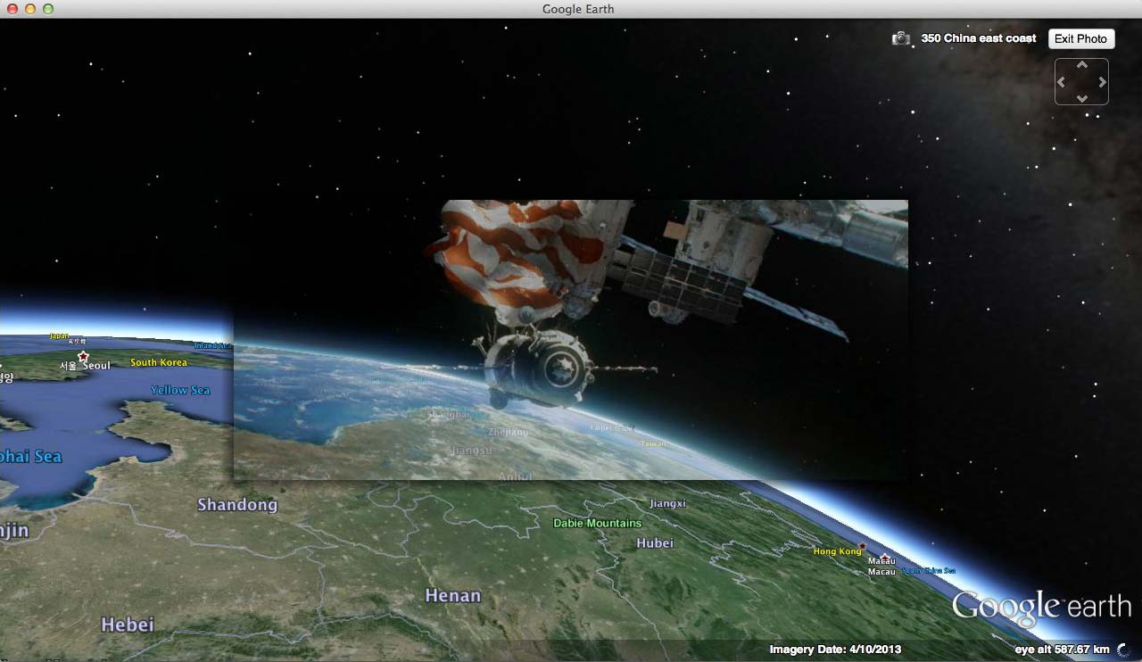
(#350)
A geospatial plot discontinuity suddenly shifts us southward again, back to the Yellow Sea and over South Korea, where ISS is hit by the second round of debris (#390-#420).
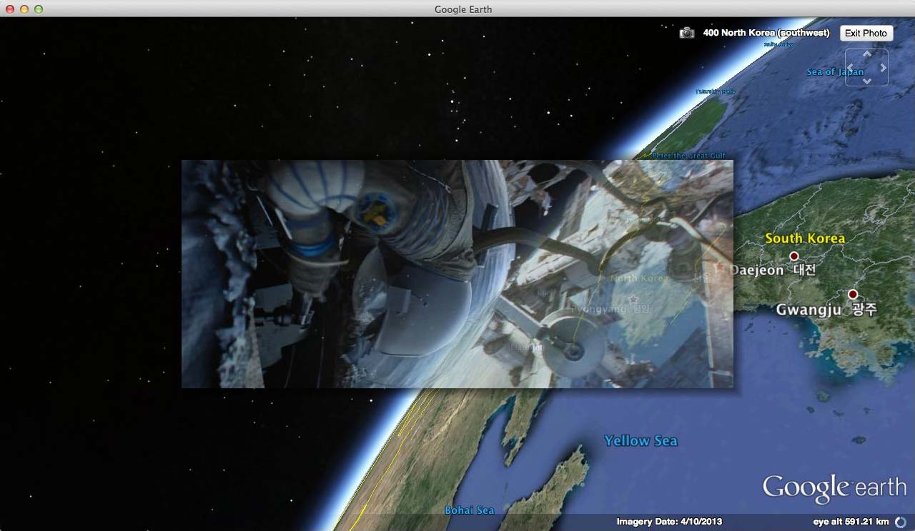
(#400)
After the Soyuz capsule frees itself from ISS, it aims for Tiangong as it drifts into the night across the Bering Strait (#430), northern Canada and Greenland, where the radio conversation with Aningaaq takes place (#440-#470). (Cuarón’s son Jonás directed a short film depicting the other end of that conversation. Note that it is daylight for Aningaaq in the short but nighttime for Soyuz as it flies over in Gravity.)
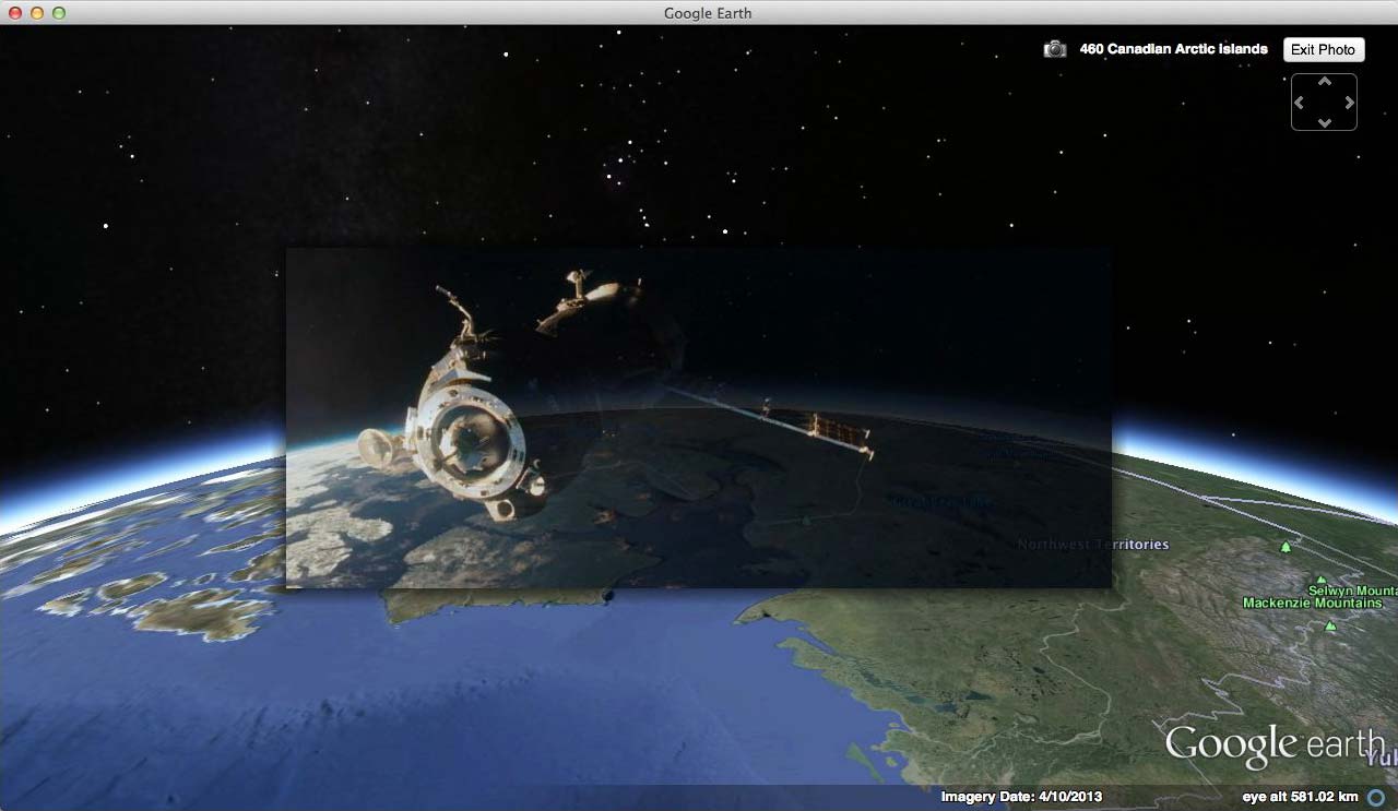
(#460)
Soyuz finally catches up with Tiangong over northern Europe (#480-#510) and over the Black Sea (#520-#530). Tiangong is in turn hit by debris as it crosses into a new dawn somewhere past the Caspian Sea (#540-#620).
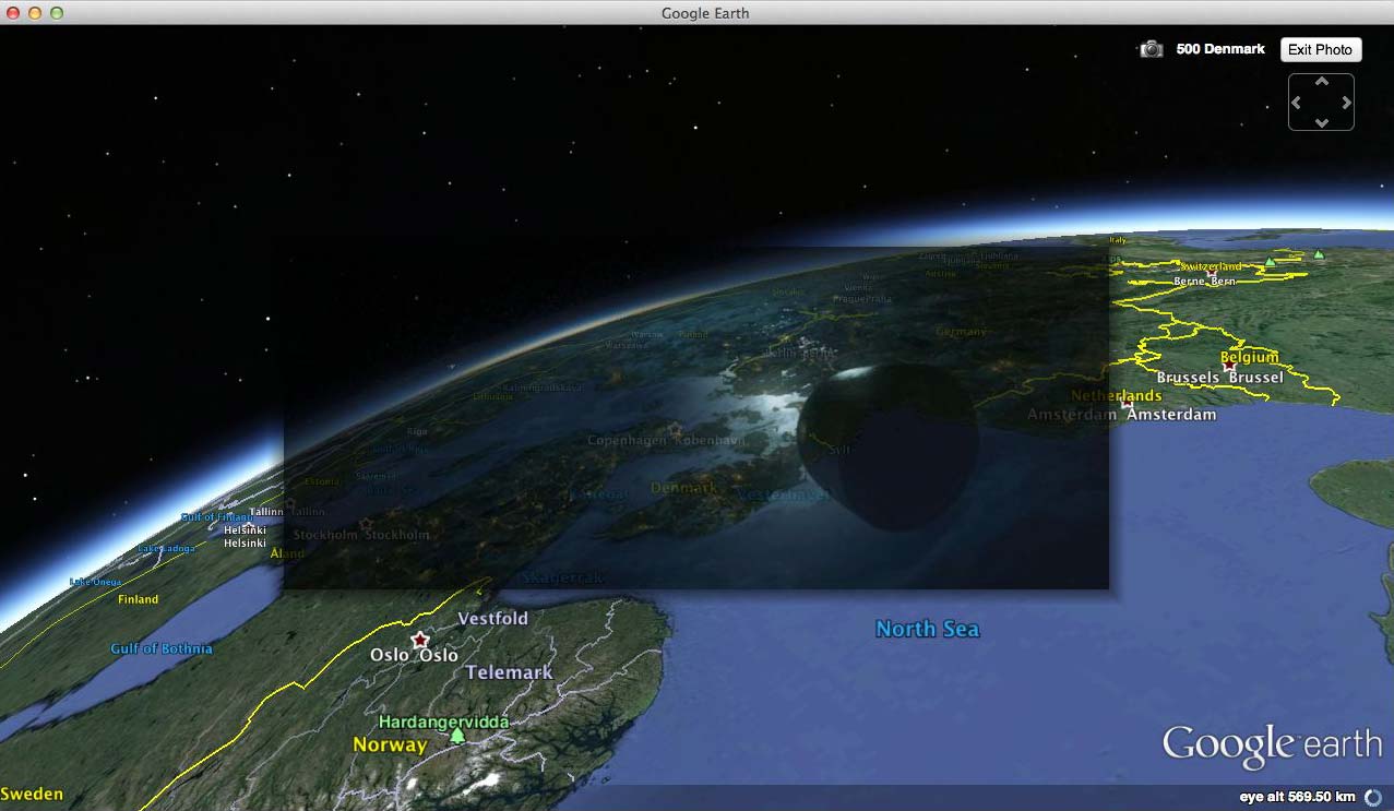
(#500)
Because of these constant northwardly turns to our protagonists’ orbital path, they never get to travel into the southern hemisphere, even though we circle the Earth. All of Gravity‘s scenes in fact happen between 2°N and 72°N; nor is there a gap in the timeline with room for a jaunt across the equator. From a strictly scientific perspective, this is problematic: All satellite orbits have to track a great circle, transposed only by the rotation of the earth during a satellite’s revolution. Thus all orbits must divide their time equally between both hemispheres.
While the film’s collisions at various stages could conceivably send the protagonists into constantly new orbital paths, I don’t think this is plausible: Both the Space Shuttle and ISS remain substantially intact until late into the movie, and thus cannot have been given sufficient lateral impetus to significantly alter their direction of movement.
Why diverge from hard science in this way? I’m sure poetic license is the reason: Perhaps the decision was made to only model the northern hemisphere, in order to get a bigger bang for the budget. Or perhaps they decided to give all major film markets a cameo role — we get a double helping of Europe, as well as a look-see of China, Japan, the US and the Middle East — all of them in the northern hemisphere.
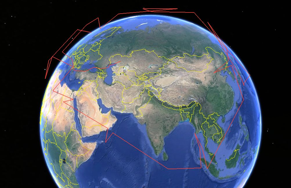
Glitches and mystery landscapes:
The largest continuity glitch, where we appear to suddenly backtrack in orbit, from past Sakhalin Island (#380) back to Korea, is closely paired with the next scene, in which a mystery landscape briefly appears (#390) before we pan back across the west coast of North Korea (#400). From that vantage point there is nothing remotely resembling the mystery landscape. We should just be seeing the Yellow Sea or China’s Shandong peninsula, which looks nothing like the landscape we see in the screen shot.
And then there is the final sequence of images accompanying the disintegrating Tiangong, none of which I’ve managed to place. The final view of the Black Sea is a perfect match (#530), but immediately before that, the sea view is not identifiable (#520). After that, we could assume that Tiangong continues its trajectory across the Caspian Sea, but none of the landscapes we see in the film fit any real topology anymore (#530-#620).
I can think of three reasons why this might be the case: 1) I can’t find them (please do let me know if you are able to georeference them). 2) Because we are now losing altitude, Gravity‘s virtual Earth backdrop is no longer suitable. Perhaps for technical reasons it only works as a globe seen from 600km up. 3) Cuarón wants the protagonists to embody a universal quality about humanity — this is clear from all the symbolic references to evolution and striving in the last minutes of the film. Making the landing spot a specific place would detract from that sense of universality, so he switches to impressionistic landscapes rather than realistic ones as we get closer to Earth.
Also this: The luxuriant lakeshore landscape we see at the end of the film is reminiscent of the prehistoric landscape that starts another science fiction classic, Kubrik’s 2001: A Space Odyssey. It would be an apt homage by Cuarón — both films take a giant leap forward for special effects in the service of science fiction realism.
There are some other quibbles, which I believe others have already adressed. For example: The orbits of the ISS, Space Shuttle and Tiangong would never be so closely aligned. ISS flies at around 400km above Earth between 52°N-52°S, Hubble sits at 560km above Earth between 30°N-30°S, while Tiangong sits at 350km, orbiting between 42°N-42°S. Even if these satellites were orbiting at nearly the same height, they paths would constantly diverge.
None of this detracts from my enjoyment of the film. Science fiction has a long and proud history of rearranging the facts to make for a better story. In The Fountains of Paradise, for example, Arthur C. Clarke shifted the entire Island of Sri Lanka 7° southward so that it could straddle the equator and host a space elevator.
Methodology:
Here’s how I made that KMZ file: The biggest clue to getting an accurate placement for the screenshots in Google Earth is the film’s opening line of text: “At 600km above Planet Earth…” This was a great help, for fixing the viewpoint above Earth at this height proved to be accurate and removed a major variable from the process. Another big clue was the Earth’s curved horizon in a screenshot. Matching the horizon removed two more degrees of freedom (tilt and field of view), leaving only a horizontal plane across which to match the angles of the landscape. Even so, each individual screenshot took between a few minutes to half an hour to place; screenshots without a horizon took the longest. (None of this fine-tuning would have been possible without use of a 3DConnexion Space navigator, a kind of 3D mouse.)
Finally, in case you’re wondering about margins of error: In almost all of the film’s shots the equivalent field of view in Google Earth is between 50°-60°; the camera’s point of view is thus at most a few hundred meters removed from the action — never hundreds of kilometers. So the kinks in the trajectory are far larger than any possible margin of error in the positioning of these screenshots.

