According to PC World, Google Earth is the best software product of 2006. It’s listed 6th overall in the magazine’s 100 Best Products of the Year.
Products one to five? Intel and AMD chips, Cragslist.org, the iPod Nano, and a Seagate portable hard drive. None of those, to the best of my knowledge, have their own dedicated blogs:-)
Note, however, that Microsoft Virtual Earth makes it to the list (#39) whereas Google Maps doesn’t. The review of “Live Local” cites the bird’s eye view feature.
First I didn’t post the Reuters article about Google Earth and H5N1, because I thought it was a republication of Christine Gorman’s article in Time from February that I remembered blogging here. It’s more of an updated version, it turns out. (Discussion at All Points Blog.)
Then I didn’t post the news that Autodesk Civil 3D authoring tool can now export to Google Earth via an extension (in a technology preview), because I thought it referred to the instructions posted three weeks ago. AECnews has more about Autodesk’s apparent change of heart.
A German website touts GPSoverIP, a patent pending internet protocol for transmitting GPS data. If I get it right, GPSoverIP eliminates an abstraction layer when communicating GIS data over the internet. The website is none too clear, but one application of it, for a GPS enabled jacket, was shown at CeBIT in 2006. (German speakers can get some more crumbs here.)
GeoRezo.net is a French-language geography portal/community site.
SOLA G1, the Japanese app for Mac and Windows that converts W3D, 3DS, OBJ and DXF files to KML, makes it to version 1.5. There are even instructions in English! (When you run it.)
World Wind Central offers up a comparison between Google Earth and NASA World Wind.
It occurred to me, after I read about the renewed volcanic activity of Mount Kathala in the Comoros and immediately had a look with Google Earth, that Google’s servers must notice surges in demand for specific geographic areas, and that these in turn would make great fodder for zeitgeist-like reports.
I wonder if usage patterns follow daylight, as awake people search locally. I wonder if league tables of the most popular places are stable, or fluctuate with the seasons. I wonder if sudden localized spikes in demand might not be useful as some kind of alert. And I would love to know what Chinese IP addresses search, or Argentine IPs, or Belgian IPs. In other words, I want my Google Earth Trends.
It’s a great tool for historians, because any primary source mentioning an eclipse can easily be dated with it (given a location), or placed (given a date). (ViaGoogle Earth Hacks) (Files for future eclipses have previously been blogged here.)
In both cases, the hardest part is navigating to get a good view. I’ve found the easiest way to move in smoothly is to “drag” the red “nipple” in the middle of the navigation panel, just like on IBM Thinkpads. I’m mentioning it only because I know some people who hadn’t noticed it before. Still, these models are pushing Google Earth to uses that hadn’t really been foreseen — which is a testament to the versatility of KML, but it also underscores the need for more versatile navigation controls in Google Earth.
If you have road data in KML or GML that you would like to serve dynamically using Java, a GIS-savvy database and the Google Maps API, then this post by Mark McLaren will save you hours. It’s a meticulously documented step-by-step account of the process.
It looks like a lot of people going to Where 2.0 also want to attend Google’s geo developer day the day before, on June 12. The event has been filled to capacity for some time, but it turns out you can now put your name on a waiting list, and Google will let you know by June 1 if they’ve found a bigger place with more room. If you’re registered for Where 2.0, you’ve got nothing to lose by adding yourself to the list.
Notes on the political, social and scientific impact of networked digital maps and geospatial imagery, with a special focus on Google Earth.
 I’ve only just now come across a KML file on Google Earth Community by yaohua2000 containing the
 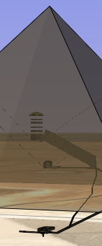 Google Earth Blog