Some great uses of Google Earth as a tool for visualizing the past::
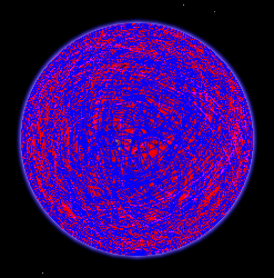 I’ve only just now come across a KML file on Google Earth Community by yaohua2000 containing the dated, categorized paths of every solar eclipse of the second millenium (i.e 1001-2000 AD).
It’s a great tool for historians, because any primary source mentioning an eclipse can easily be dated with it (given a location), or placed (given a date). (Via Google Earth Hacks) (Files for future eclipses have previously been blogged here.)
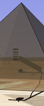 Google Earth Blog points to atf’s transparent model of the Great Pyramid of Giza, complete with all the internal passages. This follows atf’s 3D model of the tomb of Tutankhamun.
In both cases, the hardest part is navigating to get a good view. I’ve found the easiest way to move in smoothly is to “drag” the red “nipple” in the middle of the navigation panel, just like on IBM Thinkpads. I’m mentioning it only because I know some people who hadn’t noticed it before. Still, these models are pushing Google Earth to uses that hadn’t really been foreseen — which is a testament to the versatility of KML, but it also underscores the need for more versatile navigation controls in Google Earth.
Stefan, in both the Great Pyramid and King Tut files there are “views” in the form of placemarks contained in the Places folder after you load those files. If you double-click on those views you are flown to specific camera views allowing you to get some good views of the burial chambers.