Google Earth terrain update fixes glitches

News from Mountain View, CA: Ruptures in the Matrix have now been fixed! Or rather,

We pushed a reblend of terrain for the entire world. It fixes various coastline issues including the Hawaii region highlighted by that ship tsunami. For this push, there is no new data, just some cleanup. (yes, we hope to add some high-res terrain soon).

And an even better Matrix in places soon? Yum. I’ll take the blue pill, please.

Large bits of Berlin in 3D

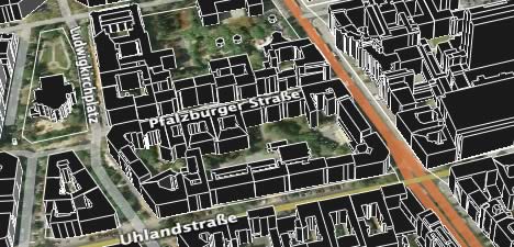
The site is in German and a bit clunky, so follow along: Once the map loads, find a bit you like using the navigation icons (though be aware that you can’t zoom out more than you already are).

When you want to export your view as KML, click on the gray button with a downwards-facing arrow. Choose the default, dargestellter Kartenausschnitt, to export your entire view. (Select Abgrenzung in der Karte angeben to make a selection inside the map, or choose the last option to search for individual landmarks.)

Next, select KMZ as your export format. Voila:

berlin3d.jpg

Of course, getting Google to serve Berlin in 3D via the default 3D Buildings layer would be even cooler. As would be textures.

And while we’re on the topic of real estate, check out John Jason Fallow’s latest flight of fancy: In Arizona, property plot polygon heights as a function of their sale value, all linked to the timeline.

Taking rail to the next level (in Switzerland)

Here’s how to take the default railroad layer in Google Earth to the next level — by connecting individual stations to their timetables. Over on Google Earth Community, Chaver shows us how, using Switzerland as an example. Nice touch: Just like with Google Earth’s base layers, zoom in to get more stations.

Wouldn’t it be cool if, in some future version of KML, the API would let you select placemarks to send to your server to do calculations on? Then you’d be able to get timetables for specific itineraries. Find and select JFK and LHR airports, press go — and get back prices. Even better, use the timeline to find bargains! (Maybe this is something for LastMinute Labs?)

This network link again makes me yearn for more comprehensive support of HTML tags in Google Earth popup windows — I’m thinking IFRAME and EMBED, specifically. That way the timetables could be right in the popup window.

NWS embraces KML (finally)

Remember the difficulty US National Weather Service employee Chuck Hodges from Tulsa had in getting approval for publishing his local weather data as KML? (Take one, two, three) That’s so 2005. Now the NWS has gone full bore with KML weather overlays of its radar imagery. These localized network links update every five minutes, contain the past 10 or so overlays, and are timeline enabled — what more do you need to get in touch with your inner weatherman? (Via Google Earth Community)

Short news: New US election layers; PR, Tenerife style

  • Frank at Google Earth Blog has been on top of the latest iteration of the US election layers in Google Earth, and now also the Washington Post IT blog covers it, exploring it in detail. But why is this IT news to the Post (and to most others covering it)? It should be political news, primarily, aimed at non-techies who would never think of looking at Google Earth to find their electoral district and candidates.
  • This article is so wrong on so many levels that we have to hope it’s because of a shoddy reporter, not a mendacious PR person. It begins “A local Canary [Islands] company is one of the first in the world to team up with Google Earth and create a property search engine, …” and it gets worse from there.

Short news: Tagzania does 3D, Snotel, Geonames, Geotagging timeline

  • Jabal al-Lughat is a linguist blog written by Lameen Souag, who has recently discovered Google Earth. He blogs how easy it is to creates collections of placemarks to create linguistic maps of places where obscure and minority languages are spoken. And indeed it is. Here’s one he’s made of where Tunisian Berber is spoken. Tip to Lameen: Use Tagzania‘s place tagging and commenting tools to create fully searchable linguistic indices. Or even just upload your KMZ file to Google Earth Community to have it show up automatically on other people’s Google Earths.
  • Speaking of Tagzania, the team behind it has landed a commission to produce 3D models of Spain’s latest architectural wonders for a video installation at the Venice Architecture Biennale (!!). You can travel to Venice to see it (until Nov 19) or you can download the models for your computer now.
  • Snowfall info is not just for skiing anymore — it’s an important leading indicator for drought. jfleck at inkstain links to the KML versions of data from the Natural Resources Conservation Service’s Snotel automated snowpack measurement stations in the western US.
  • Geonames.org fixes its ontology after some feedback from the big names in web semantics.
  • Freelancer turned Flickrer Rev Dan Catt sets the timeline straight as to who developed geotagging when.
  • I’m a bit late to report it, but what a boost for GeoRSS: National Geographic gives it a big wet sloppy kiss on the lips. Way to go GeoRSS. (NG has a whole series of articles on the digital revolution in mapping — perhaps a bit late to the party?)
  • If you want to see GĂ©oPortail’s 2D imagery draped over a 3D Google Earth, Guilhem Vellut has created a Ruby application that will fetch the relevant tiles and present them as overlays in Google Earth 4, on demand. PC only at the moment. (Via Le Blogue d LFG)
  • Newham High Street in London seems set to be coming to Google Earth sooner rather than later, courtesy of an enlightened city council and the Centre for Advanced Spatial Analysis (CASA). Comes with YouTube eyecandy.

Notes on the political, social and scientific impact of networked digital maps and geospatial imagery, with a special focus on Google Earth.