I don’t usually blog content behind paywalls, but if it involves a mention of Ogle Earth, I’m willing to bend the rules: The Atlantic Monthly has one of the most gushingly enthusiastic articles about Google Earth I’ve ever read, and it’s a wholly infectuous read. Staff writer James Fallows relates how his first use of Google Earth felt as momentous as the first time he saved a file, used a modem, used Mosaic or typed a word into a search engine.
Unlike some shallow reviews of Google Earth, Fallows rightly highlights the user-created content that has bloomed for Google Earth. And here comes the plug:
The easiest way to see what’s on offer is through sites like Ogleearth.com and Gearthblog.com. They have news and screenshots, and links to files that create the overlays for Google Earth.
(Perhaps that’s just a tad too self-referential, so I’ll atone by also linking to Google Earth Hacks and Google Earth Community.)
Couldn’t not fact-check The Atlantic, though. For an article published February 7 and intended for the March issue, the release of a Mac version early in January should be an event in the past, not a promise for the future.
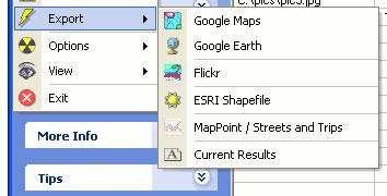
Fallows also pushes geobloggers.com as a liaison between Google Earth and Flickr; while excellent, geobloggers is currently down, so in the meantime make do with Flickr2Map, Flyr, and Flickrmap, or try Panoramio.
And finally, ESRI’s Jack Dangermond is quoted as saying, “There’s no way to connect a professional data set to Google Earth, so in a sense it is pretty thin. […] But because it is spellbinding to customers, it can only build awareness of geography.” Maybe Dangermond has a different definition for “professional” or “connect”, but there is a wealth of data converters out there, including translators for WMS, ArcGIS (Arc2Earth), CAD applications… pretty much everything 3D and geospatial is being ported to Google Earth, not least video game characters.
Temporary link to the article here.
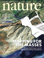 I’m off to read a whole slew of articles on mass mapping, virtual globes and in particular Google Earth in
 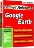 The first book dedicated to Google Earth is out and available for immediate delivery