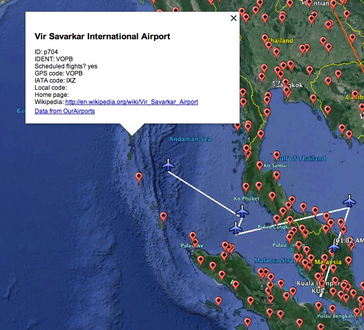
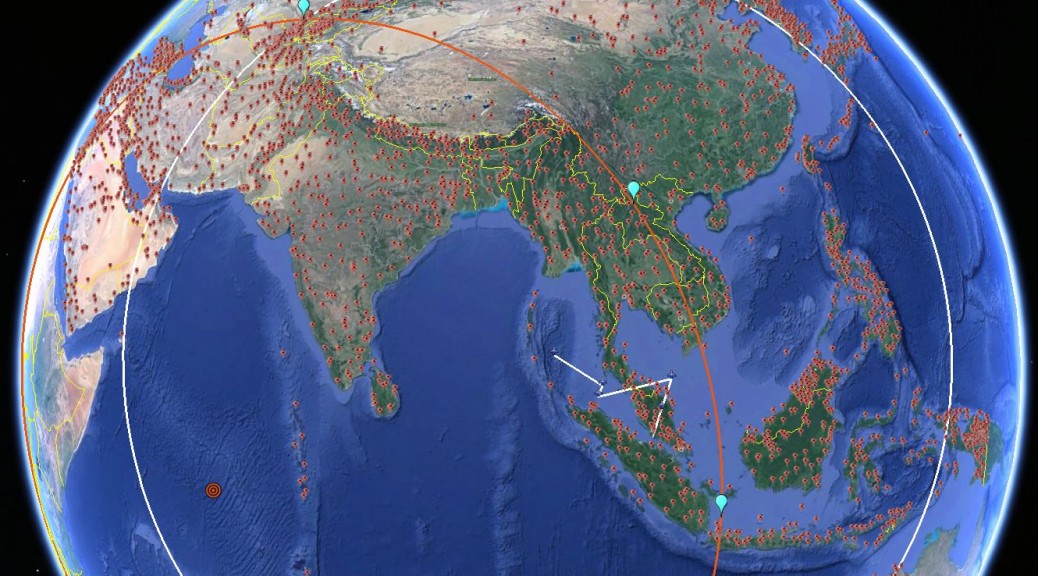
Over the weekend, several initiatives mapped airports that could serve as potential landing spots for missing Malaysian Airlines flight MH370. WNYC first mapped large airports within MH370’s flight range onto Google Maps; then David Strip used data from OurAirports to cast a wider net of potential landing spots and put that in Google Maps.
That’s a good idea, but Google Earth is perhaps the more versatile tool for doing some proper research, especially as it has historical data with which to compare new satellite data as it arrives.
So I also made a KML file for Google Earth with potential airports, from the same OurAirports data, but casting an even wider net — over 3500 potential landing spots. Here it is. (Use it in conjunction with the suggested search location KMZ file published in the previous post.)

What does this file contain? All Asian airports, minus Russian airports, plus Western Australian airports. I’ve taken out seaplane bases and heliports, but left in closed airports. I cleaned up the data for two Western Australian airports with faulty coordinates.
Why keep small and closed airports? Because in a search, this file should essentially be used to rule out potential airports. If MH370 landed somewhere (as opposed to crashing) then that airport will most likely turn out not to be on this list, or else be a small or closed airport that has recently undergone expansion. (However: Keep in mind when scouring Google Earth that satellite data may be a few years old).
I used Google Outreach’s Spreadsheet Mapper to convert the orignal data to KML. At just over 3500 data points, I was definitely pushing the limits of that technology. Here is the spreadsheet I used for this KML file.

Good brief, that *is* a lot of airports to choose from. Whilst I hope that MH370 *is* maybe located at one of them there is another important issue; Most Airports/Countries indicated have cellphone coverage, and it is extremely likely that some of the passengers would have either left their phones on accidentally during the flight – or tried (if able) to use their phone/s wherever the plane was low enough and/or close enough to any Cellular Base Station/s (?). This would thence reveal the locations and/or trajectory via signals received from the passengers’ phones…..
Do they all have airstrips that can support a 777 landing?
No. But that is the whole point. If you find an airport listed as closed or small, but it clearly isn’t any longer in the satellite image, then that might be a clue. Known large airports have a major problem — they are known. Building an airport for a 777 from scratch is a huge undertaking, but enlarging a small airport — not so much.
Qiemo airport in northwestern china is spot on the Ping-circle. Uighur terrorist kept secret by China?
By what logic would China want to keep that (and all the passengers) secret?
China usually don’t like attention of their minority groups causes. Plane hijackings are usually performed to gain attention. Thats was the case with all the hijackings by palestinians. They held the plane on the ground. Sometimes for days, with demands. If the plane has landed it would be known to that countrys gouvernment.
I heard that the last known trajectory for the plane was suspiciously on target with flight lane B466 (to Sri Lanka from Malaysia).
Here’s the logic: acknowledging that the pilot could have ditched it in the drink at any given time, and under the assumption that the pilot had some place to actually go, if there was 6-7 hours worth of gas, and they used roughly 1 hour’s worth up until their last transmission (12:40-1:30am). If they did make the turn back across Malaysia for the next signal interception (2:40am), then that is 2 hours. They would have about 4-5 hours worth of gas, maximum, which would put them just west of India (over Arabian sea). So if they turned, odds are good that they would choose Myanmar, Bangladesh or Pakistan, but probably not enough gas to get to Oman. (omitting India because of its heavy airspace traffic and would have been spotted immediately).
So, the question for me would be: how many known airports are there around that path that have runways long enough to stop a 777. (understanding that they could have changed trajectory at any point in that time, but if they thought they were no longer being tracked, they probably wouldn’t make many more false turns than one after getting into the B466 lane). Can we narrow down the list of airports, maybe?
If someone turned the transponder off couldn’t they have turned it back on later squawking a different code? If they showed up on radar at the right place and time how would anyone know it was MH370? It could have looked like a cargo plane on a filed flight plan headed to Pakistan or points north…
Transponder codes are unique (ie.hard-wired) and can not simply be re-programed by ‘operators’ to produce a new one (in part to try to stop exactly what you are suggesting Doug); Lack of code is one thing but any/all Transponder code anomalies would red flag near any airport/s…
….
Actuallly… The transponder has four digits that can be “adjusted” – typically the codes are issued by clearance. Newer transponders transmit that information as well as other pertinent information including a serial number that may serve to identify the aircraft. The ability to see that data is dependent on both the transponder and the quip meant used to interrogate same.
Sadly academic now Don but of course it depends on the actual transponder/code under consideration, I was referring primarily to the (pre-assigned) ICAO aircraft designation Code (that can’t just be simply changed/spoofed by the pilot/s) not the call-sign data:
http://en.wikipedia.org/wiki/Airline_codes
Stefan, I have onece again requested Inmarsat to release the full ping dataset for MH370 into the public domain for analysis.
Does anyone have an idea why they have not released it?