Skip to content

Ogle Earth

Search
  • About Ogle Earth
Uncategorized

Sensor webs: USGS’s WaterWatch

May 14, 2006 Stefan Geens

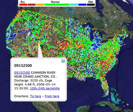
I love sensor webs, and I love the fact that the USGS is making them accessible to us. Their latest effort from March: Real-time streamgages for the US, as a network link. Each dot represents a measuring station. Click on the link in the pop-up, and get detailed granular data.
watergaga.jpg

Now you can watch droughts develop in real time across the US. (Via Rob Hetland’s web journal)

Post navigation

Previous PostShort news: GIS linklist, SPARQL geo extension, RISE-PAKNext PostGoogle Maps in Flickr: Now as a Firefox extension

Notes on the political, social and scientific impact of networked digital maps and geospatial imagery, with a special focus on Google Earth.

Archives

Subscribe via RSS

Proudly powered by WordPress