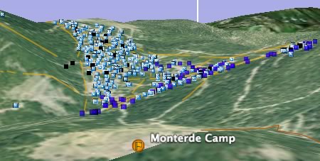
Adding location metadata to photos is perhaps the surprise hit of 2005’s mass mapping revolution, bestowing immediate benefits in terms of context and display options. For many people using Flickr or similar tools, coming across geotagged, mapped photos may well have been their first conscious encounter with GIS.
Two new tools are helping to forge the connection between a photograph and where it was taken. Both integrate with Google Earth.
ITag
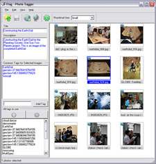 For Windows users, ITag turns adding location metadata into a matter of dragging and dropping a Google Earth placemark onto the photograph. This data can then be saved in a Flickr-compatible format for uploading to that service, or else one or more photographs can exported in a group as a KMZ file and sent to people for opening in Google Earth. (example (KMZ))
Finally, ITag will also convert GPX tracklogs made by GPS devices into KML. It’s free, so there is no reason not to try it, in case this is what you need.
Photo Map
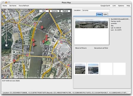
This open source project is an elaborate Firefox browser extension. The aim is “to build a better map” by tagging (panoramic) photos in Flickr or 23 with more detailed metadata (point of view, type, season, time of day…) and then displaying them on Google Local as an enhanced map. You can also launch Google Earth from the interface with a network link that shows the photographs in that context.
The project is in its incipient phase, in need of (your?) content, but it is even worth playing with just as a proof of concept.
 If you’re a user of Google Earth, sit back and wait while GIS pros suddenly find it much easier to start publishing all manner of interesting data to Google Earth. If you want to see some eyecandy, check out
  If you are a GIS pro and use ESRI’s ArcMap, then Arc2Earth is going to make your life a lot easier if you need to publish to a free, widely available geobrowser — Google Earth. Arc2Earth comes in a $99 standard version and a $299 professional version which adds TIN export, the opening of network links and, in the future, publishing to a server. There is also an API in the works.