Category Archives: Content

Sprol.com

Unlike conventional sightseeing sites, Sprol focuses on the worst Google Earth has to offer. That’s because Sprol is an environmentally activist site documenting man-made disasters, with eyecandy courtesy of Google Earth.

It’s the kind of site that Google Earth (and Maps) is perfect for, and the kind of site that presages what geography homework will start to look like come August, when the new schoolyear starts in the northern Hemisphere. (Geography teachers with access to PCs and broadband that do not incorporate Google Earth in next year’s curriculum are being borderline incompetent, IMHO.)

But Sprol, why only go half-way? Your posts should be accompanied by a KML download file of the Google Earth views that you show, so that we can all immerse ourselves fully even as we read the context.

Earthquake info

Google Earth comes with some earthquake layers built in, but those aren’t the only ones available. The USGS now also supplies its earthquake bulletins as KML files.

There are two feeds to choose from: One contains everything (>1 on the Richter scale), and the other all those >2.5 on the scale. Both feeds cover the past week, and seem to update every few minutes or so.

(Via Earthhopper on Flickr.)

Earth Search

Should it ever happen that you run out of things to look for in Google Earth, head on over to earthsearch.net, which has a browsable index of over 5 million “features”, listed by name country, type, latitude and longitude. (Okay, so there’s duplicates, but still.)

Many of these Google will find for you if you just type the name, comma, country into Google Earth’s search field (or use yubnub), but for those that it doesn’t recognize, there’s always coordinates. (A script that opens highlighted coordinates in Google Earth sounds like a great idea. Even better, perhaps, would be a script that searches earthsearch.net if Google Earth comes up blank)

If you use earthsearch.net’s own map to zoom in on a feature, you also get a list of nearby features along the side. That functionality — and this entire site — is just begging to be turned into a monster of a dynamically updated network link.

Location, location location

Now you can even use Google Earth to profit from the misfortune of others! Look:

“I’ve created a .kml file for Google Earth that displays information about pending foreclosures (Notices of Trustee Sales) in the Phoenix Metropolitan Area. It is categorized by auction date and labeled by remaining balance in dollar amounts….” (His full post)

Google Moon, properly

moon.gifBecause somebody had to do it, here is Google Moon as an overlay in Google Earth. No, it’s not at the highest resolution (just 1,024 pixels squared) and no, there is no altitude data (turn off the atmosphere and terrain to get the best results) but as a proof of concept it certainly works. Can’t wait to see Google Mars.

GoogleGlobe.com gets a dynamic network link

GoogleGlobe.com now also has a dynamically updated network link of its placemarks on Google Earth nearest your point of view. (direct link). They call it the Globe Assistant.

In an email, Erwin Nikkels at GoogleGlobe.com adds:

Also a Weblog function is integrated where you can leave your reactions about a spot. The next version of Globe Assistant may also be used to connect 3rd party databases (like real estate etc) to GoogleEarth.

I think Erwin is on to something here, if by that he means a future revenue stream. Most dynamic network links so far include a URL to a web page with the picture/link/wikipedia entry, and on those pages there sometimes are ads (often Google ads, natch). But just as RSS feeds have started carrying posts that in fact are ads, there is nothing that stops KML files from containing sponsored placemarks.

The challenge then becomes getting as wide as possible a distribution of your dynamic network link, so that more people see your sponsored placemarks. You can do this the hard way, by getting people to download your link, or you can try to see if it might not be included as a default layer in the Google Earth application. I wonder, however, if in the latter case, Google might not want something in return for the distribution of your moneymaking placemarks. After all, why should Google give anyone a free lunch? Ah, it’s a brave new world (for advertising).

BTW, I love how all manner of serendipity happens when I’m surfing the Earth with all my network links turned on. The more the merrier, I say.

A taxonomy of Google Earth KML files

I’ve found my Google Earth interests getting progressively more ornate, from focusing on zero-dimensional experiences to those in three (I’ll explain). At the same time, this trajectory provides one possible taxonomy for Google Earth KML.

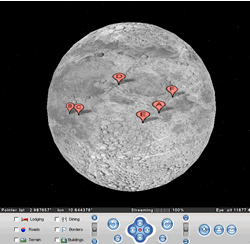
Zero dimensions: Static placemarks. First it was all about zooming in on static spots on the globe. Places from childhood, famous places, odd places… many interesting placemarks can be found on the sightseeing sites in the sidebar of this blog.

One Dimension A: Static paths. Pretty soon I discovered the Tour de France routes, and the ability to follow along them.

One Dimension B: Dynamic placemarks — the dimension in question here being time. The best examples include network links for Flickr images, del.icio.us links and Blogwise blogs.

Two dimensions A: Static overlays: For example, detailed images of Area 51 and maps of Easter Island, filling in the blanks where Google Earth goes vague. Also, global population overlays.

[Two dimensions B: Network links to dynamically updated paths? Haven’t seen any examples of this class of creature. One possible example might be the display of the optimal flight routes across the Atlantic given current Gulf Stream conditions. But that’s a bit esoteric, no?]

Three dimensions A: Network links to dynamically updated overlays. Live updated weather maps! Live traffic maps!

Three dimensions B: Static 3D models.

[Four dimensions: Network links to dynamically updated 3D models that change shape and size over time? Haven’t seen any of these either, but perhaps a model of a building site in progress would qualify. Or else colored translucent columns of different sizes across a landscape might be usable as a nifty 3D charting tool of real-time data in several dimensions at once…]