All posts by Stefan Geens

Imagery update: US, London 2006, South Georgia

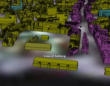
There is plenty to go see in Google Earth today, as it’s been updated with lots new content, as listed by PenguinOpus on Google Earth Community. There’s new stuff in the US, 10cm-per-pixel imagery of London from early 2006 (taken in winter, no doubt to avoid further exposure to topless sunbathers:-), plenty of new high resolution cities all over the place as well as new strips of high resolution imagery in Darfur (more about that later). As usual, Google Earth Blog has a blow-by-blow account (Look up Burning Man, and compare it to the map overlay).

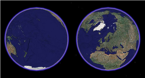
And South Georgia is no longer blurry, thanks to a gem of an image provided by the British Antarctic Survey (BAS). It is a rare cloud-free Landsat ETM+ image of the island, and it now forms the base layer for South Georgia in Google Earth.

Why is this a Good Thing ™? Because everybody wins: BAS is able to further its mandate by making such imagery available to the public, but at the same time bandwidth costs are carried by Google, which in return gets a better base layer for Google Earth. We of course win, because now we can go follow along with Shackleton’s expedition all over again, and where before things got blurry, they are now in high resolution. And finally, scientists — especially those gearing up for the International Polar Year in 2007-2008 — get a much improved canvas against which to publish their data and discoveries. Earth’s poles remain some of Google Earth’s last terra incognita, but that’s changing bit by bit.

Quality content update: Wikimapia as a network link; new global poverty maps

  • Wikimapia has been an runaway success — it even has a blog dedicated to it, Matt’s Wikimapia Blog. Matt reports that all of WikiMapia’s content is now available as a KML network link. It’s fast, unobtrusive, and works exactly as advertised — making it yet another great source of user-generated geospatial annotation. (Via my comments:-)
  • Columbia University’s Center for International Earth Science Information Network (CIESIN) has just published detailed new global geospatial poverty data, and Declan Butler has turned a subset of them to KML overlays. He’s made a global hunger map, a global infant mortality map, and a detailed poverty map of Palestine, downloadable from his blog. Declan points out that “the underlying GIS data made freely available by CIESIN allows any GIS professional to build upon them by integrating other data.” This should make the eradication of global poverty just a little easier.

Short news: KML timestamp support for iPhotoToGoogleEarth, NASA World Wind

  • iPhoto export plugin iPhotoToGoogleEarth is up to version 1.02, adding altitude data (in case you’re flying) and, yes, timestamps. If the time was in the EXIF data, it’ll now be in Google Earth — couldn’t be easier.
  • The Earth is Square lists what’s new in the soon-to-be-released NASA World Wind 1.4 beta. Impressively quickly, it sounds like KML Importer will gain timestamp support, while WMS support gets an upgrade. NWW also seems to be working on making itself prettier, with animated 3D clouds, 3D lighting and atmospheric scattering effects promised.
  • Roo Reynolds over at Eightbar makes progress on a SketchUp => Second Life converter.
  • GeoServer is up to version 1.3.4, which includes “more robust” KML output.
  • iLoveMountains.org is a US website dedicated to ending a form of mining that strips the tops off mountains. They’ve now made a virtual “National Memorial for the Mountains” pinpointing all missing mountains that exists only in Google Maps and Earth:-) (Via this Flickr post)

Denmark’s Aalborg goes 3D

You might remember how earlier this year Norway’s Bergen decided to make itself more visible to potential tourists by donating aerial imagery of the city to Google Earth. Now Danish blog Squareboy.dk points us in the direction of the city of Aalborg, which has taken a different tack in a quest for visibility: They’ve published a 3D model of the center of town as a 5.7MB KMZ file. (It’s also available as a DWG file for AutoCAD and other pro apps.)

Aalborg also carries a nice set of aerial images. Here is a comparison view of the 3D model and the bird-eye imagery:

aalborgGE.jpg

27SlottetOesteraagade.jpg

While the 3D model isn’t textured, it carries more detail than Google Earth’s default building layer. In fact, Aalborg seems to make most of their GIS resources freely available online. Obviously there is somebody enlightened working in Aalborg’s GIS department. Imagine if all cities did this.

Dept. of useless geography questions

Not long ago, a friend asked me what percentage of the world’s population I thought lived North of Stockholm. Off the top of my head, I guessed 1%. Obviously, he already knew the answer, having figured it out earlier (he’s like that) and it turns out only around 20 million people live at a higher latitude north than Stockholm, or one third of one percent of the world’s population.

Just yesterday, I sat wondering about what spot would have the most ocean surrounding it on its hemisphere, and also what spot would have the most land surrounding it. I fired up Google Earth and had a guess. Most ocean: Somewhere in the South Pacific, not surprisingly. Most land: Could it really be Stockholm?

geoq.jpg

But surely GIS pros have datasets on which they could run analysis that would confirm such spots? Also, has anyone run analysis on the Gridded Population of the World database to determine what would be the best spot for a cataclysmic meteor to hit Earth, in terms of minimizing mass death? (I’m assuming perhaps naively that not being in the same hemisphere as ground zero makes you safe.) My guess is that the “best” site would be somewhere on Antarctica. As luck would have it, that is exactly where the world’s largest known meteorite crater lies buried.

Google Earth COM API for PC now documented (Beta)

Indeed, this is important enough to mod up from the comments:

On September 26, the component object model (COM) application programming interface (API) for Google Earth 4 Beta for PC was given public documentation by its developers. Here it is. And here is the announcement on Google Earth Community. Much is made by the developers of the fact that this is a Beta release of the API, that there is no official support, that it could change at any moment, etc… Still, great news.

First impression: The vocabulary is much more extensive than the equivalent in AppleScript: Here’s hoping these can be made sufficiently functionally equivalent so that future helper applications can be ported with relative ease between operating systems. And I’m curious — is there an API waiting in the wings for the Linux version of Google Earth?

Car navigation mode for Google Earth

An enterprising japanese programmer, Nitoyon, has added an extra navigation mode to the three Google Earth comes with. To do this, he accessed Google Earth’s 4.0 beta’s undocumented COM API (for PC) with a JavaScript app, allowing you to steer Google Earth’s view and location in a way that exactly replicates many of those beloved car driving games.

Ever the web 2.0 netizen, Nitoyon’s put a video on YouTube showing you how it works:

Download the application from his home page. It worked well for me, though it helped to first go to a place I wanted to drive and then fire up Nitoyon’s JavaScript. The fact that the height above the car is maintained in mountainous locations is a very nice touch.