By releasing a KML file outlining all the new imagery added to Google Earth in the latest update, Google has greatly amplified the usefulness of its imagery. That’s because isolated image tile updates of remote locations are often requested by satellite imagery customers for a purpose, perhaps because they contain a interesting feature that has recently changed. But finding such new imagery from one update to the next is akin to looking for the proverbial needle in the haystack.
No longer. Now, there is a whole new sport available to us — guessing why a spot in the middle of nowhere just got a shiny new meter-resolution satellite update. After all, some organization paid good money for that tile. (By the terms of the agreement between Google and DigitalGlobe, Google eventually gets to use all imagery taken by DigitalGlobe. There are exceptions — Iraq and Afghanistan are devoid of updates.)
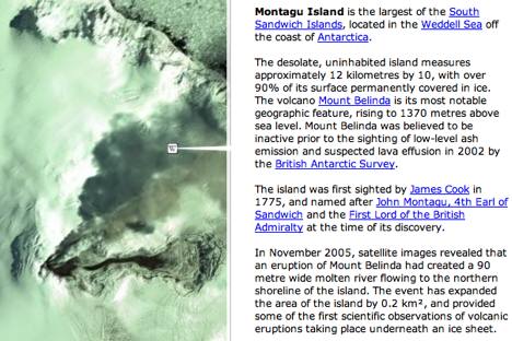
In the briefest of inspections of the new imagery aided by the KML outline file, I zoomed in on South Sandwich’s Montagu Island, wondering why that remote place merited a now highly conspicuous close-up. A click on the accompanying Wikipedia icon answered my question adroitly: The island is volcanically active, providing “some of the first scientific observations of volcanic eruptions taking place underneath an ice sheet.” Sure enough:
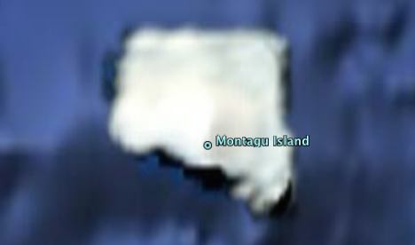
Just last week, Montagu Island still looked like this in Google Earth:
I would never have noticed the difference and learned something new without that KML file.
Now, onwards to tiles in Iran, North Korea, India, Pakistan, Syria, Sudan… Remember, the Israeli air strike on Syria’s mystery nuclear reactor on September 6, 2007 was preceded by a flurry of satellite activity over the region, as evinced by the DigitalGlobe default Google Earth layer outlining its catalogue of tiles (though the most recent ones were not yet available in Google Earth at the time of the strike).
My IMac software, Appeworks 6 & Acrobat 1.7.258 unable to open KML. Any advice?