Google Earth Community sysop PenguinOpus writes:
Feb 13th Updated data layers: Google Earth Community layers updated (as of Jan24th), North American Car Ferries, improved Community Showcase layers.
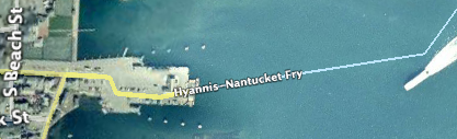
Zoom in close enough, and indeed, there are now ferries aplenty:
Driving directions don’t yet include ferry routes, however; Google Earth still sends you from Fire Island to Rhode Island via New York City. Volkswagen drivers beware:-)
How would you get from Fire Island to Rhode Island, except via NYC? And indeed, how do you do it at all without taking a ferry?
Oops, I meant Shelter Island. I did my road directions search from Greenport to Boston.