The BBC reports that for the first time, the location of Hitler’s bunker in Berlin has been officially identified and marked with an information panel. This is the place where Hitler killed himself, in April 1945.
The bunker lies around 200 meters from the Holocaust Memorial, beneath a parking lot outside some apartment buildings. What’s frustrating about the BBC’s reporting, however, is that this particular story screams out for georeferencing, and yet there is not a marker or link to a map anywhere. These days, news organizations really should be able to call upon geospatial resources at will. Understandably, this information might need to be collected by the journalist in the field, but how much extra effort does it take to capture GPS coordinates for a story and send them along when you file it?
In any case, taking into consideration the information provided by the article, the photo that accompanies it, the pictures on this site about Hitler’s bunker and the high resolution images of Berlin in Google Earth, it’s possible to triangulate the position to precisely here.
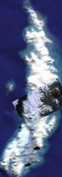 The most recent Google Earth dataset update (see
  Google Earth has received a major dataset upgrade overnight. The entire globe is now marked with new strips of high resolution imagery, much of it in regions with low population densities. This is without a doubt the single largest high-resolution update yet, in terms of surface area.