Category Archives: Uncategorized

PhotoOverlay: Works inside pyramids too

Every day at 9am and 1pm, a small group of people who wait in line get to pay 100 Egyptian pounds ($18) to climb into the Great Pyramid of Khufu and all the way up to the burial chamber. Cameras are confiscated at the entrance, because otherwise who will buy the postcards? Luckily my Nokia N95 was let through as it was deemed just a phone.

Standing in the middle of the most impressive architectural feat ever (in my opinion) is a humbling moment. It’s very warm in there, and there is a very deep and pervasive rumble, which we eventually sourced to the ancient ventilation shafts, through which the air was rushing. I took out my camera phone — not surprisingly, there is no reception inside a 7 million tonne stone monument.

A visiting friend happened to be walking up the steps of the Great Gallery so I took a picture. Where exactly were we? ATF’s accurate 3D model of the pyramid provides the best possible contextual information, and since you can now accurately position photos on Google Earth, why not combine the two?

khufu.jpg

khufu2.jpg

Download ATF’s model of the Great Pyramid, then download this photo, added using version 4.2’s <PhotoOverlay> tag, to see where inside the pyramid it was taken.

The Economist covers the geoweb

A disadvantage of living in Cairo is that The Economist doesn’t arrive at newsstands until Monday, Sunday if you’re lucky. Fortunately Tech Consumer points the way to the online edition of this week’s Economist Tech Quarterly insert, whose leader article is one of the best overviews I’ve read of the geoweb, neogeography, virtual globes, mashups, and the security and privacy implications. There’s references to Snow Crash and copious quotes from interviews with Google Earth’s Michael Jones and John Hanke and Microsoft Virtual Earth’s Vincent Tao: The world on your desktop. It is free to read without a subscription (at least for me, at the moment).

That this article should appear just now and so prominently in a newspaper with a large readership in the business world is a bit uncanny, given this week’s revelation that Google Earth Free has become a legitimate tool for use at work. All those CEOs calling their CTOs asking why they don’t have Google Earth installed on their corporate laptop can now be told there is no legal reason why not:-)

While there’s not much news in the article for those who have been reading the geoblogs closely these past few years, for everyone else this is a lucid and penetrating introduction to the geoweb. If your mother has been wondering what precisely this geoweb is and has been complaining how she doesn’t understand any of it, send her the link to this article. I have:-)

New EULA for Google Earth Free/Plus: “Internal use” at work is OK

Frank Taylor brings news of the newly updated release notes for Google Earth version 4.2 and rightly homes in on a major change: Updated terms of service for Google Earth Free and Plus.

In brief: You can now use it at work for “internal use”.

The most important bit of the new license now reads like this:

1. USE OF SOFTWARE; RESTRICTIONS

Use of Software. For an individual end user, the Software is made available to and may be used by you only for your personal, non-commercial use according to these Terms of Service and the Software documentation. For a business entity user, the Software may be used by you and your employees for internal use according to these Terms of Service and the Software documentation (individual end users and business end users are collectively referred to as “You” herein).

Restrictions. You agree not to use the Software in connection with or in conjunction with a system in a vehicle that offers real-time route guidance or turn-by-turn maneuvers. You agree not to use the Software for any bulk printing or downloading of imagery, data or other content.

Whereas previously we had this, in version 4.1:

1. USE OF SOFTWARE The Software is made available to you for your personal, non-commercial use only. You may not use the Software or the geographical information made available for display using the Software, or any prints or screen outputs generated with the Software in any commercial or business environment or for any commercial or business purposes for yourself or any third parties. You may not use the Google Software in any manner that could damage, disable, overburden, or impair Google’s services (e.g., you may not use the Google Software in an automated manner), nor may you use Software in any manner that could interfere with any other party’s use and enjoyment of Google’s services.

(My italics) A “Find Differences” in BBEdit finds very few further differences between the two texts. Lawyers wanting to peruse both texts can use this link to the license from version 4.1. One minor change in version 4.2 is a link to a standardized Google policy on privacy (instead of spelling it out in the text). Google’s data licensors are also referenced together with Google when posting disclaimers, and this paragraph is new:

3. PROPRIETARY RIGHTS

a. Google. […]

b. Third Parties. Data for map content in the Software is provided under license from Google’s licensors, including by Tele Atlas North America, Inc. (“TANA”) (the “TANA Data”), and is subject to intellectual property rights owned by or licensed by TANA and such other licensors. You agree that you will not engage in, and may be held liable for any unauthorized copying or disclosure of this material. By using the Software, you agree to make TANA a third party beneficiary of this agreement. Your use of TANA Data is subject to additional restrictions located in the following Legal Notices page: http://www.google.com/intl/en_us/help/legalnotices_maps.html.

So what does “internal use” mean for a business user? I am not a lawyer, but my understanding is that Google Earth Free finally becomes a proper universal browser of georeferenced data. You no longer need Pro to do geoweb surfing at work, or to search and view KML files, even for doing business-related research or intelligence gathering, much as you would use an ordinary web browser to gather information from the ordinary web. Nevertheless, I suspect this new license does preclude businesses from using the Free application to produce commercial geospatial products. That would result in an “external” application of Google Earth. But, again, IANAL. Google Earth’s “Software documentation” is given as a source for further explication, but the online legal FAQs are currently still the old ones.

Also of interest is the restriction that prevents third parties from offering a sat-nav solution for cars that involves running Google Earth, much like the setup demoed by Volkswagen 18 months ago.

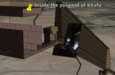
(Note: I’m still working setting up a reliable internet connection (again) in a very hot Cairo, so pardon the flagging blogging around here for another week.)

Neogeo job, anyone?

Looking for a neogeo job?

Links: Google flight sim, updated user guide, send to car

Summer is ending in Sweden; after a final brief jaunt to the Stockholm Archipelago this weekend, I’m heading back to Cairo. In the meantime, Google Earth news hasn’t stood still:

  • Flight Sim: Marco Galotta discovers a fully-fledged flight simulator hidden inside Google Earth! Ctrl+Alt+A gets you there in Windows, Command+Option+A on a Mac. There’s an official page listing flight simulator keyboard shortcuts on earth.google.com.
  • Google Earth User Guide: The Google Earth user guide has been updated to reflect the changes in version 4.2 beta, including system requirements.
  • Pattern recognition: An intriguing thread wherein DigitalGlobe is looking to have its imagery be made more accessible by experimenting with the Numenta Platform for Intelligent Computing (NuPIC) and its hierarchical temporal memory system (HTM), which aids with pattern recognition.
  • Send to car: While Google Lat Long Blog announces that Google Maps’ “Send to Car” feature for directions will soon be available to all European BMW Assist customers, a press release by Mercedes announces that US customers will soon be able to start using the same feature, and additionally also send directions from Yahoo Maps. And Digital Urban looks at 3D sat nav for cities, to be rolled out by Tele Atlas in the coming months.
  • FlashEarth popup: Over on the nearby.org.uk blog, Barry Hunter hacked together a network link that shows the view from the FlashEarth mapping application inside a popup in Google Earth (for PC only). He then goes and tweaks it, producing this final version.
  • More video: Other content taking advantage of KML 2.2: Digital Urban flags the Virtual Tourism Blog‘s KML layer of georeferenced videos

HeyWhatsThat.com creates first Earth-Sky mashup

Michael Kosowsky, of HeyWhatsThat.com — a site that generates horizons for specific locations from DEM data — has emailed friends of the site to announce compatibility with Google Sky.

This is the first Earth-Sky mashup I’ve come across, and it’s a tour de force. I’ll let Michael explain: (slightly edited)

Executive Summary:

  • At http://www.heywhatsthat.com generate a new panorama or view an existing one.
  • Hit the new “at night” button just below the “View in Google Earth by day” button.
  • Google Earth opens, switches to sky mode, and overlays the celestial sphere with the horizon, visible summits and an azimuth-altitude grid for that location at the current time.

Details:
Google Sky isn’t as good as other astronomy applications at some tasks. For example, there’s no way to indicate what portion of the sky is visible from a given location at a given time. But because Google Earth is extensible, third parties can provide functionality. And since HeyWhatsThat.com specializes in drawing your horizon…

So now when you’re looking at a panorama on HeyWhatsThat, you’ll find that instead of a “View on Google Earth” button there are two buttons: “View in Google Earth by day” and “at night”. Hit “at night” and Google Earth will open up and overlay the celestial sphere with your computed horizon and peaks and an azimuth-altitude grid reflecting the state of the sky at that instant.

You may find you have to manually switch to sky view, and if you don’t see the overlays — blue horizon line, red summit markers, and green grid lines — you’ll have to refresh the network link you just loaded: look in Google Earth for an entry on the left under Temporary Places labeled something like “Planisphere for XXXX (current),” right-click on it, and select “refresh.” And note that you can refresh it any time and the horizon will be adjusted to the current time.

(Advanced question: should I just send down the KML file rather than a NetworkLink when you click “at night”? A link that you can refresh at any time to update to current conditions is real nice, but in my testing GE hasn’t been completely reliable about refreshing the Network Link when it first receives it, forcing the complexity of the previous paragraph.)

Unfortunately, it’s been cloudy every night since the Google Sky announcement, so I haven’t been able to field test this code, but it does nicely match my childhood planisphere. In particular, I don’t currently correct for astronomical refraction, which should depress the apparent horizon by half a minute of arc; maybe tonight I’ll get to see if that would be useful.

More:
You can do more by crafting custom URLs, including computing the horizon for any specified time and for any arbitrary latitude and longitude, even locations above 60 degrees north and below 54 degrees south where we don’t have elevation data. For example,

http://www.heywhatsthat.com/bin/planisphere.cgi?lat=44.2&lon=-69.1

refers to that latitude and longitude at the current time, and

http://www.heywhatsthat.com/bin/planisphere.cgi?id=9UK4EFG7&date=8/23/2007+10:20pm+EDT

refers to the computed panorama for Bald Mountain at 10:20pm EDT on August 23. Browse to either of those links and you’ll receive the corresponding KML file; create a network link using them and you’ll be able to refresh the link at any time. See the technical FAQ for details.

If you use a URL for a fixed latitude/longitude (e.g. the first example above), the computation assumes a flat horizon, rather than trying to compute the true horizon by finding all the mountains. Arguably this is adequate for most applications — one seasoned amateur astronomer pointed out that your horizon can be off by as much as five degrees and you won’t care, because most of the time you’re looking higher in the sky — but then you can’t answer questions like “Hey, what’s that right above Bald Mountain?”

Just one note: Using a Mac with Firefox returned files with “.cgi” as the suffix, and these did not load in Google Earth. I manually changed the suffix to “.kml”, after which they loaded just fine. Fixed.

I’m so glad this blog is writing itself this week:-)