Category Archives: Uncategorized

Google Geo Developer day notes, cont.

Much of the mainstream news about Google Geo Developer Day just rewrote the press release. But this was different:

Search Engine Watch‘s Greg Sterling writes a long post, from the perspective of a GIS outsider at Google’s Geo Developer Day:

The level of enthusiasm from developers in the room yesterday was very interesting to observe. Speakers were interrupted by loud applause several times in response to various techical statements. Such remarks and the response to them were generally lost on me until their significance was explained in English. It was at times a little like being in a foreign film without subtitles.

:-)

And via 3pointD, a post about the ($10,000 per year) enterprise version of Google Maps, on the Official Google Enterprise Blog.

WMS reflector script for KML 2.1

Wow, that was fast. Over on Random Notes, Jason Birch has written a WMS-to-KML reflector script (in PHP) that takes advantage of KML 2.1’s nested regions feature. He puts up the source code, and examples too. No rest for the geeks.

Short news: Google Earth for Linux (screenshots), GeoServer

  • Here’s what Google Earth looks like on Linux, thanks to Dexae and Flickr.
  • GeoServer “is a fully functional WFS-T and WMS server that follows the OGC open standards.” Version 1.3.1, just out, has enhanced support for KML, and there is a built-in reflector script to serve WMS data to a network link.
  • Tagzania Blog identifies the exact location in Iraq where the Haditha incident occurred, based on high resolution images in Time magazine.
  • Both The Earth is Square and Bull’s Rambles point to new high resolution imagery layers of the US for NASA World Wind.

KML 2.1 specs, tutorial; National Geographic update

  • Here’s the Google Earth KML 2.1 Tutorial. Everything you’ve ever wanted to know about KML 2.1 since a few hours ago.
  • And here’s the KML 2.1 Specification.
  • Frank at Google Earth Blog points out that the National Geographic Layer now contains plenty of placemarks over North America, not just Africa.

    natgeousa.jpg

  • Remember that Google Earth 4.0 is _beta_. After some heavy use, my copy started to crash repeatedly as I zoomed over a specific region. Trashing the settings file didn’t help. Trashing the cache file did.

No injunction for Skyline against Google Earth

…And the news just comes on flooding in:

Skyline Software Systems is denied a preliminary injunction to stop Google from distributing Google Earth, reports ZDNet.

U.S. District Judge Douglas Woodlock on Friday denied a preliminary injunction requested by a Virginia-based company called Skyline Software Systems, which alleges that Google Earth violates its terrain-mapping patent.

A notice posted on the court’s Web site says that Woodlock announced his decision in a telephone conference with attorneys involved in the case without publishing a written opinion.

Previously about Skyline:

Keyhole co-founder disses Skyline suit

Skyline press release dated April 4

Google Geo Developer day notes: Press release, Improved KML, cool demos

Some more notes:

First off, here is the official press release. Item: There’s been over 100 million downloads of Google Earth, says Google Earth/Maps Director John Hanke. Google also estimates there are over 30,000 websites using the Google Maps API to make mashups.

Barry Hunter at Nearby.co.uk zooms in on the subtleties of the improvements made to KML: He looks at textures within KML (which uses the COLLADA XML Schema), how KML can “stream” much more efficiently by being linked to specific regions, and at updates inside network links.

The Google Earth 4.0 download page has some very interesting new demos of the power of this new, improved KML.:

ZDNet covers Google’s live launch event, where The San Francisco example above was demoed. ZDNet quotes Google Earth CTO Michael Jones:

“Developers can place images on top of (the map) that span the whole earth,” Jones said, half-jokingly calling it a “time travel” application. “I think people will use it to share ancient maps, (and share) information about possible future developments.”

Meanwhile, from John Hanke’s post on the Official Google Blog, blogged earlier:

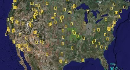
  • The latest data update from a few days ago increased high resolution coverage by 300%; now around 20% of the Earth’s landmass is covered, according to Google Earth/Maps Director John Hanke.
  • Localized version of Google Earth have “unique local information layers for those countries.” Hmm. I might want those too…

Also, I checked: SketchUp Free for Mac is not a universal binary application yet.

Google announces SketchUp Free for Mac, KML support for Google Maps

Now the Official Google Blog has its entry on the new version of Google Earth, and more besides. Highlights:

  • SketchUp Free for Mac is out! There is a new version for Windows as well — use it to export textured models to Google Earth 4.0.
  • Upload KML in Google Maps,, simply by copying and pasting the file’s URL into the Maps text window! This will really speed the adoption of KML. Here is an example using event site Shnitzl‘s KML.
  • The Google Maps API now supports geocoding for the US, Canada, Japan, France, Italy, Germany and Spain.
  • Google Maps for Enterprise is a fee based service and support option for businesses who want to embed Google Maps in their websites.