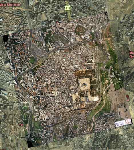
For the first time since I’ve started looking, a high resolution satellite image of Jerusalem is available on the web. Until now, such imagery has not been available because of an inane pre-geoweb US law called the Kyl-Bingaman Amendment, which prohibits US satellite operators like Digital Globe from selling imagery of Israel and the Palestinian Territories at resolutions higher than what is commercially available in the rest of the world (currently 2m per pixel). I’ve ranted about Kyl-Bingaman before.
Imagine my pleasant surprise to find Chris Pendleton blogging a new service by TerraPixel that lets you “patch” bits of Microsoft Virtual Earth where the imagery might be low-resolution of old, replacing it with your own imagery, or imagery provided by TerraPixel.
Chris points to TerraPixel’s demo, and specifically to the “Holy Patch” sample, which overlays a high resolution map of Jerusalem’s old city over Virtual Earth’s pixellated base layer (courtesy of Messrs. Kyl and Bingaman). Wonderful!
Interestingly, the image has some metadata stamped right on it:
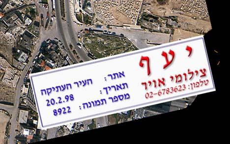
That seems to point to an acquisition date of 1998 (alas Hebrew is not a script I’ve mustered), though this would jar with TerraPixel’s own description of the patch:
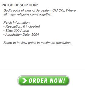
Also, I’m not so sure the high resolution imagery is 6 inches per per pixel. I’m guessing it’s more like 50cm per pixel.
Still, now that such imagery is in the wild, here’s hoping that this officially makes the Kyl-Bingaman amendment moot and that we can soon all enjoy high resolution shots of Ceasarea, Armageddon, Askelon, Masada, Bet She’an and Jericho.
Hebrew text is:
Yaaf Aerial Photography
Phone: 02-6783623
Site: Old City
Date: 20.2.98
Photo No.: 8922