A real potpourri of content here — some of it old, and listed here more for my own reference, but that is the inevitable consequence of a gorgeous summer week in Sweden and a full work agenda.
- 3G iPhone does GPS: No surprises there. Apple’s page on the GPS functionality, and Apple’s page on GPS + Google Maps. Interesting feature:
If GPS is available, iPhone displays a blue GPS indicator. But if you’re inside — without a clear line of sight to a GPS satellite — iPhone finds you via Wi-Fi. If you’re not in range of a Wi-Fi hot spot, iPhone finds you using cellular towers.
My Nokia N95 doesn’t do that. I wonder: Will Google come out with a version of the web API that also works on the iPhone’s browser?
- Kyoto sights: In the Disney news crush from last week, another layer got overlooked: In the Travel and Tourism folder of Google Earth you’ll now also find the Kyoto Tourism layer, by the Kyoto Tourism Council. Understated, but extensive.
- Earth browsing: Is there are a thaw in Earthbrowser developer Matt Giger’s frosty view of Google? First, he gets invited to present a talk at Google about his Earthbrowser, next he has kind words for the Google Earth API…;-)
- KML Validator: Galdos Systems Inc announces the free KML validator. Unlike existing KML validator Feed Validator, Galdos’s validator can handle KML 2.2, according to Galdos’s Ron Lake.
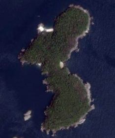
- Geoblogging Sudan: Michael Graham, of the United States Holocaust Memorial Museum, has a new post up on World is Witness, their geoblog, this time from South Sudan.
- Google Earth web flight sim: Jim Stafford of Barnabu.co.uk comes out with a simple flight sim using the Google Earth web API. He’s also responsible for an interactive bouncing ball demo.
- Hello Earth: How to build a simple Hello Earth application with the Google Earth web API, courtesy of the new Google Geo Developers Blog.
- Flickr KML feed as a Google Earth web plugin: A simple page that loads a Flickr KML feed into an instance of Google Earth for a web browser. (See video demo.) You can easily copy the code and alter the feed URL (but get your own API key) to make your own version. This example is a nice way of learning the ropes.
- GE API Google Group: Not previously mentioned here, but there is an active Google Group that deals specifically with the Google Earth web API.
- Géoportail 3D goes Mac and Linux: The French state’s national GIS portal Géoportail gets 3D support for Mac (Safari only) and Linux (Firefox) via new plugins for the TerraExplorer technology by SkyLine Systems.
- Cities in 3D for Europe. A program to get cities to contribute their own GIS data to Google Earth has now gone multilingual, aimed at European local governments. Not just ortho photography and terrain DEMs are welcome, but 3D models as well.
The more the merrier, of course, but the accompanying video showing the purported benefits of contributing 3D models seems to me like an mix of both wishful thinking (“Airport management and contractors, for example, would have a shared tool for more effectively providing maintenance services or coordinating deliveries” &mdash, with a static 3D model? How?) and unambitious goals (“Tourists can discover great places to stay, such as this hotel.”) I think rich contextual data is far more important to tourists than a pretty 3D model; fortunately Google is getting good at rich georeferenced data as well.
- Flash Earth no longer does Google: An Eagle-eyed reader notices that Flash Earth no longer sports the option of showing Google’s map tiles. Likely culprit is the unorthodox means by which Flash Earth uses the tiles, which no doubt contravened the TOS.
- Mobile Second Life client: A 165KB java app by Vollee does the trick. I get 2 frames per second on my Nokia N95, but there I am flying through Second House of Sweden on my mobile, chatting with the locals. As a technology demonstration, it’s impressive.