Blogging in a RESTful manner…

John Bailey at the Alaska Volcano Observatory & Arctic Region Supercomputing Center sent Frank Taylor and I an information-packed email with heaps of stuff that is bound to be relevant to Ogle Earth readers, so I’m posting it here verbatim, embellished with just a few extra links:

I’d been meaning to email you with a few things that might have flown below your radar (not that much does), and in a couple of cases people have beaten me to it:

  • New Scientist: Frank heard about the New Scientist article from a reader. This was but together by Jon Blower as part of the follow-up to the NIEeS workshop he ran in Cambridge a few weeks ago. I was there, and it was an interesting experience — most notably for a chance to compare GE to World Wind to ArcGIS Explorer side-by-side (Note: the KML support in the latter is pretty bad still). Also, as a general theme of workshops to introduce/promote virtual globes to scientists this was one on the first big events, so it was good to see what worked & what didn’t. Look to see further followup appearing on NIEeS GridIndfo, their wiki.
  • KML Workshop: The leasons learnt in Cambridge I was able to put into action a few weeks latter at a small hands-on workshop I gave at the GSA cordilleran section meeting. You’ll notice the general layout of the KML exercises is similar to something the Google team put togther (and one of you blogged) and used in Cambridge and other events. I’m giving some internal workshops at the University of Alaska Fairbanks this summer, so I will be improving/developing what I have and keeping it online as a resource.
  • Science/Virtual Globes Events: There’s been a rash of conference/workshop events the lately but after ISDE there’s nothing new on the horizon. However, we are planning on putting on events at the AGU 2007 Fall Meeting again. I’ll send you more details when I have them. But in the meantime I update my conferences webpage at least once a month, so if you hear of anything good please let me know.
  • Volcano/Virtual Globe Publications: A Geotimes article on Google Earth and Volcanoes (Smithsonian and AVO), was out in print in Feb, and is now freely available online.
  • I also thought the following might be of interest as I submitted it a couple of weeks ago, just before Stefan posted his thoughts on KML3.0’s needs: It’s the full paper that accompanies the talk (Telling a story in Google Earth – the 2006 eruption of Augustine Volcano) I’ll be giving at ISDE5. Although the latter [talk] I haven’t prepared yet because who knows what Google or others might produce in the next month!
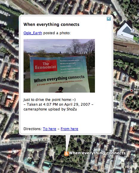
  • And for amusement, if you saw the Wired News article they wrote about me in January, that got picked up in the blogs another time and slightly re-written with an amusing title: Google Fights against Volcano Eruptions (!!!)
  • Other Virtual Globe Publications: Wall Street Journal article. I talked with the reporter about this, not really too sure why, I think he was initially planning to go in a different direction.
  • An interesting white paper on Microsoft Virtual Earth by Danyel Fisher, who notes that the map servers retain a record of all map tile requests. He says that “Tile server logs are standard IIS logs; they store an IP address, a date and times of access and a URL”. This might not be news in the world of virtual globes, but I’m not sure its been put in a reference-able paper before.
  • Random: You may or may not know that Rory Dooley contacted me about giving free SpaceNavigators to all those who presented at AGU… which he did. In return we have been providing feedback. Our friend Valery, since he had one given to him by Google when I took him to visit, gave his to David Ralliant who has been using it in ways it was not intended (as those two are apt to do).

    Apparently he was planning to use it at the Virtual Globe Innovations in Paris during the French GIS show GeoEvenement he was part of and has promised to send pictures.

John also points to FeatureServer, which is a server application that lets you upload, edit and publish geospatial data using the REST “architecture”. (What is REST?). Output formats include both KML and GeoRSS, and there is a KML storage demo. Hard-core networking coders seem very excited about REST, so it will be interesting to see how geospatial implementations of it, like FeatureServer, develop.

And if you haven’t clicked on the link to the unorthodox use of the SpaceNavigator, then you’re really missing out on something:-)

Links: Twango does sound & KML, ArcGIS Explorer updated, AIM2KML, Yahoo! Pipes does KML

Wow, that’s five whole days without posting. I could plead all kinds of extenuating circumstances, but that would take too long:-) Better to just post all the interesting new stuff from the past week anon:

  • Twango is a media-uploading service that you can email files to (including from your mobile phone) and geocode via text in the message body. The results are now available as network links — your own personal ones, and aggregated ones too.

    What’s interesting about Twango is that you can send not just photos or videos, but also sound files (and PDFs, MS Office files, XML, Zip…) I would love for Twango to get native ShoZu support, as that would give me the ability to publish automatically georeferenced podcasts/sound recordings to the web using my phone’s built-in GPS. (A Twango API is coming.)

  • There is a new build of ESRI ArcGIS Explorer out, Build 380. James Fee has a series of short posts about it, but is still unimpressed by the app’s KML support. Sebastian Good at It is what it is‘s finds much improved WMS support.
  • Devgrind experiments with visualizing calendar data spatially. In this case, iCal data is turned into KML using Ruby (check out the screenshot). None of the original data is geospatial, but KML is proving useful even for non-geographic spatial visualizations. (See also this 3D chart using KML, blogged previously)
  • Search Engine Land:

    Belgian newspapers that sued Google to be removed from its index are now back in, having agreed to use the commonly-accepted blocking standards that they initially rejected as not being legal.

    Silly Belgian papers. At least now there is a legal precedent for accepting the the existing opt-out methods and standards.

    Just wondering though, will we have a metadata standard in KML for opting out of indexing or caching (as opposed to the robots.txt method)? Is it possible to publish a KML document today and request that Google not show it as a result of a search in Google Earth?

  • AIM conversations as Great Circle segments in Google Earth. (Home page, KML file)
  • FonFinder developer Rainer Simon is looking at building a Twitter interface for FonFinder, in a follow-up to this post on Ogle Earth.
  • Chad at The Earth is Square has a new KML version out of his Mogadishu Refugee migration layer.
  • The geospatial components in Yahoo! Pipes get KML output support. This is worth playing more with, when I get the time. O’Reilly Radar has more. I especially like the Kiva Loans by Location pipe example.
  • Life in the Fast Lane has an interesting article about the making of emotion maps (like the recent one in San Francisco).
  • I’ve been meaning to review HoudahGeo, the new geocoding app for the Mac. In the meantime, version 1.0.5 is out. I still plan to write it up, time-permitting — my initial impression was that while the application’s workflow concept is compelling, it was still a bit buggy. Frequent updates are fixing the bugs, though. (I do wish there was a way of round-tripping the added EXIF coordinate data back into my Aperture photo library, however — something currently not possible. It remains the case that almost all photos in my library do not have coordinate data in their EXIF tags, and I am still looking for a solution that lets me add such data without having to reimport photos.)
  • Ascent is a feature-heavy sports-tracking application for the Mac that also outputs to KML. Check out the screenshots. User Bob Rudis wanted to make the application a bit more social, so he has written an AppleScript folder action to automatically upload the resulting KML to a server and then let everyone view it in Google Maps.
  • 3DConnexion’s SpaceNavigator now also works with Microsoft Virtual Earth natively (if you’re browsing on a PC), in addition to Google Earth for PC and NASA World Wind for PC. Which reminds me: When will Google Earth for Mac officially support SpaceNavigator? Is it too much to hope for Virtual Earth 2D support in Mac browsers? You could still use SpaceNavigator to pan and zoom, if not tilt and rotate.
  • Export Law Blog has an interesting take on the US ban on downloads of Google Earth in Sudan.
  • The highly anticipated (at least by me) GeoCommons is launching at Where 2.0 on May 28.
  • Mathematica 6, a brand-new version of Wolfram’s uber-application, comes with heaps of interesting demonstrations, some of which are relevant to the Earth sciences. The accompanying free Mathematica Player is not a dedicated geospatial viewer, but it does do all sorts of 3D visualizations well, so it is worth checking out if you’re looking for an interactive geospatial education tools.
  • prontosBR.com is a Brazil-centric collaborative sightseeing site, focusing mainly on Brazilian imagery. With links to Google Earth.
  • GeoGarage, by France’s Magic Instinct Software, is a new server product for publishing maps and orthophotos to the internet. The sample Flash plugins feel very responsive, and the output is also available via Google Maps and as KML overlays. I don’t know enough about similar products to judge whether the price is a bargain, but GeoGarage is aimed at organizations that would otherwise not have the budget to publish geospatial content.

N95 corner:

  • First firmware update for the N95.
  • Another example of how the future of blogging is extreme niche blogging: Sami Lempinen’s Mac.sis, “Making Macs and S60 handsets talk”. Then there is also Tommi’s S60 applications blog, which points to an interesting post about various ways to sync Macs and Nokias. Both Tommi Vilkamo and Sami are Finnish, both work at Nokia, and both write a personal blog about their day job in their spare time. Talk about enthusiasm:-)

Word of warning re the posting frequency here these next 4 weeks: It may get mighty sporadic due to looming project deadlines that are going to have to take precedence…

Flickr => KML redux

Well, it seems like my initial assertion that getting geotagged Flickr images into Google Earth wasn’t possible is not quite true. It is possible, but until yesterday’s post, it wasn’t really all that well documented:-)

That has now been fixed. There are currently three ways in which geotagged Flickr images can be published to Google Earth (that I know of) — and the latter two methods are good for turning any GeoRSS feed into a KML network link.

connectskmln95.jpg

Method 1: Trippermap ($10/year)

Trippermap is a (mostly free) service that lets you use Google Earth to geotag Flickr photos, and then publish those photos to a map which you can embed on your website. If you get the premium account, the map will also provide a link to a KML version of the images — but as the map is Flash-based, the URL for the file is not explicitly visible. I asked Mark Zeman, the creator of Trippermap, what the URL is, and he was happy to oblige with the info:

It’s http://www.trippermap.com/v2/trippermap.kml?nsid=41072040@N00

Where “41072040@N00” is value of the “trippermap_user” variable, which you can find in the pastable HTML code that Trippermap provides for your maps (look under the “get your map” tab). Mark says he is looking into offering a downloadable network link for that URL, but for now, I’ve rolled my own.

What’s not clear to me is how often Trippermap refreshes the feed. It seems to respond mainly when I prod it into refreshing — perhaps this is because it doesn’t sample the GeoRSS feed directly but instead talks to Flickr via the API — which it does above all when I ask it to. On the plus side, this does allow me to micromanage the content of my feed.

Method 2: Mapufacture (free)

Mapufacture is a very simple concept, implemented well. It is a tool for aggregating different GeoRSS feeds, with output as either a new GeoRSS feed or KML. If a map has just one GeoRSS feed, then the GeoRSS output is not much value added, but the KML certainly is.

Here is the mapufacture URL for the Google Maps-based map for my Flickr feed, and here is the accompanying KML link. As it is not a network link by default, I’ve made one that references it: Voila.

The only challenge with Mapufacture is that the process for creating a new map is light on the documentation and not entirely intuitive. (For example, you first have to create a blank map, and only afterwards can you add the content.). It’s also a little sluggish when setting up a map, though the resulting feeds are fast.

One tip: Make sure to append “&georss=true” the the original Flickr GeoRSS feed’s URL, or else your map won’t have any images in it at all.

Another tip: You can use Mapufacture’s GeoRSS output with Google Maps, like so. Unlike when you put Flickr’s GeoRSS feed directly into Google Maps, wich creates doubles for every entry, routing it via Mapufacture get rid of the extra entries.

Method 3: Geonames’s RSS to KML converter, using Barry Hunter’s new wrapper (free)

Geonames.org has long had an RSS/GeoRSS to KML converter, though without showing an explicit URL for the service. Unless you were willing to hack, this was good only for one-off static conversions, as there was no URL for you to stick into a network link.

Fortunately for us, Nearby.org.uk’s Barry Hunter is both able and willing as a hacker, so today he whipped up a page that uses Geonames to give us a wealth of conversion options for RSS/GeoRSS feeds: Just the static KML link, a copyable URL for that link, a preset network link, a link to the feed in Google Maps, and finally, a URL that is readymade for the Google Maps API.

Tip: Here too, remember to append “&georss=true” to the original Flickr GeoRSS feed’s URL when you paste it into Barry’s converter. Notice also how Barry’s coding automatically removes the duplicates that plague a direct import of Flickr into Google Maps.

Geonames’s focus on a streamlined converter that gets its variables directly from the URL makes Barry’s hack a very fast and responsive tool. Here, then, is the network link for my georeferenced images, created using Barry’s hack.

Of course, if Google Earth were to gain the ability to read GeoRSS feeds, then there would be no need to burden third-party servers for a conversion to KML every time somebody requests an update to your images…

Thanks to Andrew Turner and Barry Hunter, who commented on this post.)

Mapping the phylogeny of avian flu in Google Earth

A comprehensive phylogenetic visualization of the avian flu virus (phylogenetics = the mapping of genetic mutations over time and space) has just been published (press release) and its centerpiece is a KML file that shows the evolution of the virus as it travels out of East Asia and into Europe and Africa. Here is the KMZ file:

phylobeaut.jpg

We’ve seen these shapes before in Google Earth. In fact, almost exactly a year ago Andrew Hill published a teaser of this data. At the time, this blog wished Google Earth had a timeline function — that wish has now been granted, and Andrew has been quick to take advantage of the technology: You can now see the virus mutate as a function of both space and time. It’s a mesmerizing but sobering sight.

Using the timeline is not the only cool thing about this visualization. I especially like how the KMZ file uses a combination of radio boxes and screen overlays to create what looks a lot like a list of interactive PowerPoint slides. It’s a technique well worth remembering:

GEslideshow.jpg

The article itself you’ll have to buy, but the eyecandy is free. And really, who reads Systematic Biology for the articles? :-)

(Via H5N1)

Chile: Fact-checking Villa O’Higgins

A Chilean village in Patagonia on the border with Chile is shown as belonging to Argentina in Google Earth, reports Reuters:

The Chilean government wants Google to fix its Earth geographical search program that places a village named after Chilean independence hero Bernardo O’Higgins in Argentina.

A quick check shows this to indeed be the case:

Ohiggins.jpg

Villa O’Higgins does indeed seem to be mislabeled, the border mismapped, and all this uncontested by Argentina — a rare factual error. (Google’s Megan Quinn says they’re looking for more accurate data for the region.)

Both the place and border data is provided by Europa Technologies. I wonder how this error managed to get into the dataset: Is the border we see an old border? Fiction? :-) It’d be great to find out.

Moral of the story (not that you haven’t heard it here before): People (and their governments) care deeply about the accuracy of Google’s geographic data. The upside: With masses of people fact-checking the minutest details of Google’s dataset every day, it must be getting quite accurate indeed by now.

N95 + photo => ShoZu => Flickr => GeoRSS => Google Maps

Thankyouthankyouthankyou Dr Andrew Hudson-Smith for leading the way to that holy grail of Nokia N95 usership: No-fuss uploads of just-taken, automatically geotagged photos to my Flickr account, viewable live by anyone via Google Maps while I’m still in the field taking pictures.

The hero of Andrew’s story is a wonderful application named ShoZu, which I think is destined for fame and fortune as more of these kinds of phones go on sale.

Basically, ShoZu is a conduit between all the photos and videos on your phone and the myriad of web services you can post them to. It does this by remembering your userids and passwords for each service, and then publishing the content you select via that service’s API. It’s free.

You can post images, video and/or text directly to Blogger, WordPress, TypePad, Vox, LiveJournal, Google’s Picasaweb, YouTube, Blip.tv, Windows Live Spaces, Flickr and many more lesser known services, some of which sound quite intriguing (like Qipit).

You can also send stuff to an email address, to an FTP server, or — and this is just amazing — the BBC or CNN, in case the submission is newsworthy. To publish content, you can either use your phone account’s data connection (which may be expensive), or you can wait until you get within range of wifi.

As Andrew notices, Shozu has an option that automatically adds coordinate data to the photos you take if a GPS fix is available. Currently on the N95, you need to “hotwire” the GPS tracking by running another program that turns it on, like the built-in maps program or Nokia’s free Sports Tracker. An upcoming version of ShoZu will be able to turn on the GPS tracking module all by itself, writes a ShoZu developer in a comment to Andrew’s post.

When you upload a georeferenced picture to Flickr with ShoZu, it is automatically geotagged, which of course means that it is viewable on Flickr’s own map, but also via your own personal GeoRSS feed. While Flickr’s map functionality is lovely, it lacks high resolution imagery in areas crucial to me (Sweden, Egypt, Belgium), so instead I subscribe to the feed using Google Maps’s support for GeoRSS. Here is my newly minted Google Maps geotagged Flickr feed. Notice how accurate the GPS fixes are — indeed, to within 10 meters in every case. (I’m not sure why I’m getting duplicate items at the moment, though.)

So what are the next steps for seeing this service become more seamless?

I’m hoping that Shozu will soon support Panoramio. This would also solve another problem: There is currently no easy free way to subscribe to my georeferenced Flickr photos in Google Earth, because Google Earth does not currently support GeoRSS feed subscriptions, like Google Maps does. (Trippermap does provide a KML feed for a user’s Flickr photos, at $10 per year. I’ll be giving that a try.) Of course, an easier solution would be for Google Earth to support GeoRSS — something which Rev Dan Catt asks for eloquently here:-)

I’d also like to be able to paste an inline Google Map of my Flickr GeoRSS feed onto my website. Perhaps Flickr could offer feed options, filtering for just the most recent 10 pictures or two weeks’ worth of photos or so — something which will have people coming back for more. (Or perhaps Feedburner could get GeoRSS support so I can roll my own feeds.)

It would also be nice if Picasaweb were to become geospatially enabled. You can use Google’s standalone photo management program, Picasa, to geotag photos with Google Earth, but this information is not used when you publish the result to Picasaweb. This is one opportunity for integration between two Google properties — A Google Earth network link from Picasaweb — which hasn’t yet been taken advantage of.

And how about automatically geotagged videos? I noticed this past weekend when uploading my videos of a little protest rally I was at here in Stockholm is that YouTube now asks you (optionally) for the date when the video was taken, and where exactly it was taken. Is Google building a database of georeferenced videos? A geospatially enabled YouTube, perhaps with a default layer in Google Earth if/when inline video arrives to that application, would truly be a stunner. Want to see all the videos taken at a specific football match? You’d just zoom in on the stadium, filter for the specific day, and see the game from as many different angles as there are video uploads.

Links: Hello Nokia N95, EarthNC free, US architecture

I’m back in Stockholm for a week for work, and the first thing I did when I got off the plane was walk into a mobile phone store and get me a Nokia N95. I’ve had little time to play with it yet, but the GPS functionality sure works, and I am looking forward to finding out cool geospatial uses for it. I’m very relieved I write a geospatially themed blog, as it has provided the perfect foil for rationalizing the purchase of a $1,000 phone “mobile multimedia computer” (yes, that’s how much it costs in Sweden.)

Meanwhile a quick processing of Ogle Earth’s various inboxes and alerts:

  • Tagzania now also lets you post routes (in addition to placemarks), and Luistxo shows you how.
  • A localized version of Google Maps for Belgium is now live — forgot to mention that last week. This also means directions in Google Earth now work for Belgium.
  • Virgil Zetterlind of EarthNC, producers of marine charts for Google Earth, writes in that there is now a free online version of the charts. Both the free and the Plus version (on CD or downloadable) have recently been made Mac and Linux compatible.
  • The American Institute of Architects gets a default layer in Google Earth sporting really gorgeous textured models of American architectural icons. Frank has details, and a video demo. (Press release)
  • Got a Mac? Then check out this Dashboard widget: TNTmap. “TNTmap is a set of interconnected widgets designed to locate, organize, and view WMS geodata”, including in Google Earth.
  • San Francisco Emotion Map, in KML.
  • The “aid worker” who figured out that you can no longer download Google Earth in Sudan has a blog. And a good one it is too.