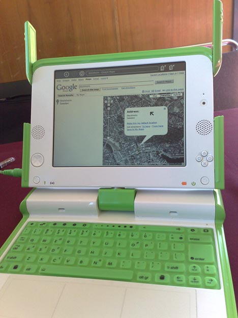
I played hooky on some of the ISDE5 conference proceedings, only to find a pretty green One Laptop Per Child (OLPC) computer sitting all by itself in a conference room, which drew me to it like a moth to a flame. It turns out that an ISDE volunteer, Ed Cherlin, had one on loan from Google to show off to people here. I was smitten.
What did I end up doing with it? Check today’s web mapping tools for compatibility with the OLPC browser, obviously. How did they fare?
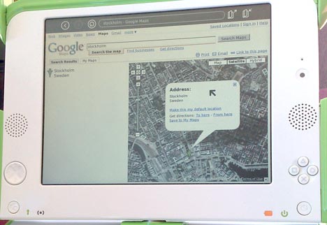
Google Maps passed with flying colors. It looked just like how it looks on my Firefox:
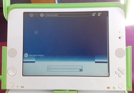
Microsoft Virtual Earth? Not so much. It wasn’t possible to get it to show a map, though I was welcome to search as much as I wanted:
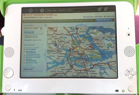
Yahoo! Maps? The new beta didn’t manage to show a map, but presumably that’s why they call it a beta:
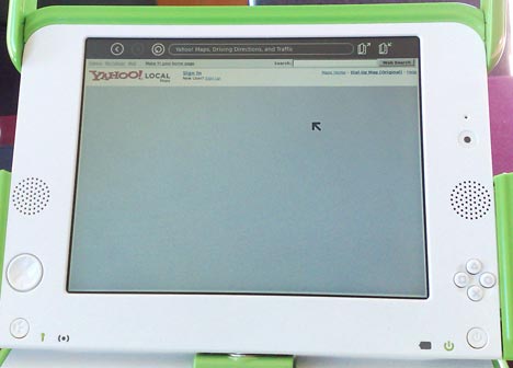
The classic Yahoo! Maps worked without a hitch:
The upshot? Even if you can’t get Google Earth on the OLPC, you will definitely be able to visualize KML files, as you can load these up via Google Maps. Good to see, too, that Google has OLPCs to play with, test for compatibility and loan out to conferences to help evangelize these. Are there OLPCs on Microsoft’s and Yahoo!’s campuses?
The problem with VE is that they use some kind of user-agent sniffing. When I open VE in Opera I can see this search page too. I have to cloak as Internet Explorer or Firefox and then it works (with some minor issues in layout and navigation).
So probably everything that isn’t IE/Fx (including OLPC browser) will get a search page instead of a map.
New Yahoo is made in Flash and AFAIR OLPC doesn’t have Flash plugin installed (at least not OOTB).
There’s an important map out there that you didn’t try: OpenLayers. OpenLayers has been tested on the OLPC, and indeed, our vector support got an additional test case for SVG support by working with the guys working on the OLPC project. We’ve been in conversation with them for a couple weeks, and would like to see them include OpenLayers + feature drawing as an activity they could distribute on the box.
Remember that these are designed for developing countries: places where the standard data in Google Maps and the like tends to fall down. The best tool for these is not going to be the same thing that’s the best tool in the US: it may be that loading up some portion of vmap0 and landsat data onto the central server for a set of these, and using something like MapServer to draw it, is actually the best that can be offered, even better than something like Google, which isn’t going to be concentrating on someplace like Africa explicitly.
Most important with OpenLayers is that you also get an oppourtunity to create geodata — so you can provide a general map, but you can also create a map of your route to the river, or mark dangerous pitfalls along a trail or what have you.
Of course, using the other services depends on actually being able to connect to the net — which is obviously not always going to be possible. OpenLayers lets you create an encapsulated package that doesn’t go to the net, and that’s going to be more important in a case where network access doesn’t exist than the actual behavior of any other web-access required mapping API.
Yep, I tested my OpenLayers app on an XO in April.
You tested the “technical capability” of the maps. However, I don’t think Stockholm or NYC is the target area of OLPC. Why don’t you point GoogleMaps to coverage in India or anywhere in Africa? None of the major data providers will help you there.
However, using OpenLayers and either satellite data, or OpenStreetMap data, then you can actually have proper, local data.
Imagine thousands of kids/people running around, creating their own data and maps of their communities.
Indeed. I’d be interested to know which map-drawing applications – such as my own Potlatch for OpenStreetMap – will work on OLPC.
When it comes to an educational Google Earth experience for low-spec computers
“Marble Desktop Globe” is certainly going to be soon one of the best apps for this purpose:
It doesn’t use OpenGL (and still provides a quite fast virtual globe), comes with a sophisticated offline database that offers the biggest bang for the byte (http://www.kde-apps.org/content/show.php/Marble+-+Desktop+Globe?content=55105
A newer version is currently close to a release which will offer seemless online download of satellite image tiles and several improvements over version 0.3.