Links: KML => OGC? Berlin in 3D? Sky-map.org

I’m in Cairo and loving it, and just now firmly ensconced in a fast internet café on Zamalek island, catching up on events of the past week:

  • Metacarta press release announcing support for KML, February 26, 2007:

    For the first time, companies and governments can now search unstructured text documents for geographic locations and visualize these references on a map using Google Earth, ESRI ArcGIS Explorer or NASA World Wind interfaces.

    How is that different from the Metacarta press release announcing support for KML on May 15, 2006? That was for Google Earth Enterprise only. (The original post on Ogle Earth.)

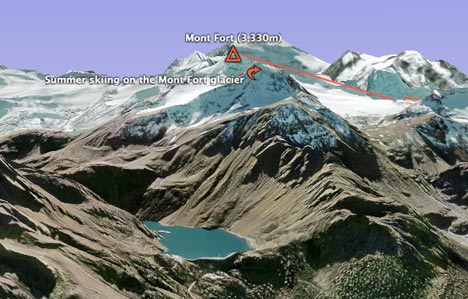
  • Quirky but fascinating KML content of the month: White-tailed deer density in Connecticut. (Via GIS Planet, which has more info.)
  • Looks like the process of making KML an open format, managed by the Open Geospatial Consortium (OGC) is under way. All Points Blog points us at the discussion. I wonder if this means that the bulk of the rapid development we’ve seen have been made — previously, the Google Earth team has argued that opening the format would slow such innovation, and that it would make KML open once the torrid pace subsided.
  • Internetnews.com’s Nicholas Carlson talks to Google Earth Product Manager Peter Birch, and comes away with these interesting bits of info:
    • He too gets told there is no Second Life-like future for Google Earth. It’s all going to be about the real world.
    • We’re now talking 200 million downloads, (up from 100 million in June 2006 and near 0 in June 2005). That’s an increasing pace.
    • Google’s monetization strategy for Google Earth will involve selling priority placements in KML search results, in a manner analogous to Google Search.
  • More about Google Earth’s demographics on Pi: Quiet Musing, whose author was at at a presentation by the Google Earth team of Google Earth Enterprise.

    One astounding statistic quoted was the vast number of users GE has been able to accumulate over its short life- approximately 200 million; reportedly many more than those by Google Maps, with nearly 80% for casual uses. And a surprising number, or so we are told, falls in the 45+ age group.

    It would be interesting to know what the criteria for casual use are, and how the age group data was gathered.

  • If my German is not worse than I imagine it, then according to this article, Berlin is coming to a Google Earth near you in all its three-dimensional glory on March 8, brought to you by Berlin’s business promotion body, Berlin Partner. They may be the second city to announce this, but if Hamburg doesn’t hurry up, Berlin may soon be the first to go all 3D (if that is what we get — the article talks about using cadastral data, but without informing us if the resulting buildings will be textured.)
  • Only tangentially related, via comments, but awesome: Sky-map.org is exactly analogous to Google Maps, but for the night sky. I love the fact that you can get live coordinate data, a permalink to a specific view (!) and also that you can overlay the Sloan Digital Sky Survey (SDSS) over your view (!!). Here, for example, is a permalink to the SDSS view of M13, a massive globular cluster. How come I didn’t know about this before?:-)

Google Earth update makes Alps sparkle

I’m a relatively bad skier. That’s okay, I’ve only done it three times before in my life, so I can still pretend that I’m a fast learner, especially as I have friends who are very good skiers and who are glad to teach me. They also think it is hilarious to take me up steep slopes and then watch me tumble down them — as was the case with my ascent by cable car of the Mont Fort mountain (3,330m) near Verbier in Switzerland earlier this week, and the far less dignified descent on skis down a glacier. But at least you can appreciate the view when you’re on your ass in the snow.

All this as a prelude to the absolutely stunning imagery and terrain upgrade of Switzerland (and other places) that the Google Earth team rolled out on February 28. I had last checked up on Mont Fort in Google Earth what must have been hours before the update, and the difference is spectacular.

montfortandlake.jpg

The terrain (DEM) upgrade to a resolution of 10 meters for all of Switzerland is probably the most important single improvement. Now, mountain lakes and dams are rendered with pinpoint accuracy, and mountain slope imagery no longer suffers from misalignment with the DEM.

mountainlake.jpg

The terrain upgrade also makes Google Earth what must be the best tool anywhere for planning your skiing (in Switzerland). This is 3D terrain information that is actually usable, and ski resort operators would be crazy not to build a version of their ski slopes in Google Earth, where they show cable cars routes with actual buildings, annotated ski slope routes, off-piste suggestions and even avalanche-prone areas. And if you’re a GIS developer, you’d be crazy not to pitch this idea to them:-) especially as the intended users won’t be businesses and hence don’t need Google Earth Pro licenses to consume your work.

I had a quick go drawing the routes of the cable cars that take you from Verbier to Mont Fort, just as a proof of concept. As an added bonus, the new imagery shows an actual ski trail of somebody summer skiing on Mont Fort’s glacier. It’s not as scary as it looks. On my way down, I eventually came to rest near a Swedish mom commending her helmeted child on what a fine job he had done skiing down the glacier. I called out to my expert skiing buddy, “look, I’m being beaten by a 10-year old boy”, only to have me corrected by the mom, “actually, she’s a 6-year old girl.” That’s how the Swedes produce those Anja Pärsons.

I really wish I had taken my GPS device with me (Nokia N95, where are you?) but with standard DEMs, there really isn’t much point when trying to track your progress in mountains on Google Earth. Now (in Switzerland), GPS tracking and DEMs have similar accuracy, and that makes all the difference in a mountainous region.

<rant>As an aside, this kind of high resolution data — both imagery and terrain — is occasionally referred to cynically on NASA World Wind developer’s blog Bull’s rambles as being wonderful if all you want to do is look at your own house. I think that misses the point entirely (perhaps intentionally). Sub-meter imagery resolution makes available a whole new world of social information, because it is at this resolution that we can start seeing objects that we interact with in our daily lives. I think it’s the killer feature for geobrowsers, but there is also a more serious benefit, and this was shown during Katrina and the Pakistan quake, back in 2005. In these cases, seeing somebody’s house became a matter of life and death. In other cases, this kind of resolution can document human rights abuses. If I can also see my own house, that’s great. </rant>

Finally, here are the rest of the improvements, as noted on Google Earth Community:

  • Entire country of Switzerland at 50cm and many Swiss cities at 25cm (thank you, Endoxon)
  • Entire country of Switzerland terrain at 10m, the Swiss Alps are now high-res!
  • Entire country of Denmark at 50cm
  • Australia day flyover
  • Cities of France: Lyon; Le Mans; Lourdes; Reims; Nancy; Limoges; Lille; Arles
  • Potsdam and Magdeburg, Germany
  • Barcelona, Belem, CapeTown, Galapagos (Isabella Island), Manaus, Mt Saint Helens, Recife, Rio, Venice)
  • Whistler British Columbia
  • Full state coverage for Wyoming & Utah
  • significant amounts of new Digital Globe data

    Oh, I almost forgot. Gratuitous shot of a pixel-perfect Matterhorn:

    matterhorn-new.jpg