Rip sends an interesting submission, and wonders if this is an example of Google Earth imagery being used as intelligence in warfare.
Northeast Intelligence Network has posted images of a Hezbollah command and control bunker captured by Israeli forces during the Lebanon war from last July. One of the images shows a wall montage of satellite imagery that is immediately recognizable as being of northern Israel:
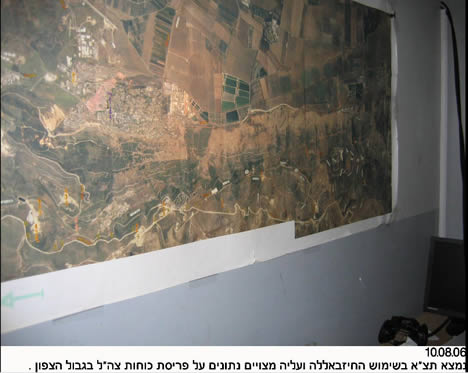
Rip wondered if that might be high resolution printouts from Google Earth. Well, there is a way to check:
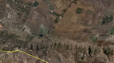
Notice there are a few clouds near the green fields in the center of the Google Earth image, so we can be sure Hezbollah’s intelligence does not come via Google Earth. Why should it — Iran has access to much better than 2-meters-per-pixel resolution, which is what is currently the highest resolution publicly available.
This also means, of course, that the argument against releasing high resolution imagery of Israel is weak. Those who want to do Israel harm already have access to the imagery, so why not release it to everyone, where it might do some good?
How do we know that the imagery that was found in the bunker wasn’t the imagery GE was serving up 6 months ago, or last year?
Once people get past the “wow, there’s my house” the next step is to go temporal. When will Google data services start even reporting simple metadata, such as date of currently served imagery, much less allowing selection of different image dates?
As soon as you start paying for it, probably.
Ah, thanks Android, forgot to mention that. Before last summer, GE’s imagery of Israel was much much lower — at around 10m per pixel. It looked like the low resolution bits just to the west of the location.