You might remember how earlier this year Norway’s Bergen decided to make itself more visible to potential tourists by donating aerial imagery of the city to Google Earth. Now Danish blog Squareboy.dk points us in the direction of the city of Aalborg, which has taken a different tack in a quest for visibility: They’ve published a 3D model of the center of town as a 5.7MB KMZ file. (It’s also available as a DWG file for AutoCAD and other pro apps.)
Aalborg also carries a nice set of aerial images. Here is a comparison view of the 3D model and the bird-eye imagery:
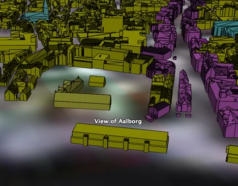
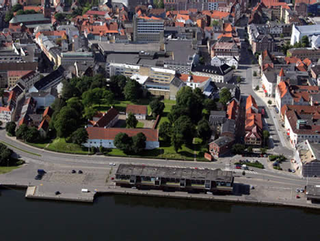
While the 3D model isn’t textured, it carries more detail than Google Earth’s default building layer. In fact, Aalborg seems to make most of their GIS resources freely available online. Obviously there is somebody enlightened working in Aalborg’s GIS department. Imagine if all cities did this.
Aalborg is not the only city to have this. The entire Copenhagen model is freely available at http://www.planogarkitektur.kk.dk/Byplanl%C3%A6gning/Bymodel%20over%20K%C3%B8benhavn.aspx
Actually this is a simplified model of the original detailed model made up of over 7 mio faces.