Parallels Desktop for Mac 3: Not ready yet for virtual globes

I’ve spent some time playing with the new Parallels Desktop for Mac 3, a Windows (and Linux) virtualization tool for OS X that has just gained 3D graphics support. The big question: Is the 3D graphics support compatible with the Windows virtual globes that have no Mac counterpart — NASA World Wind, Microsoft Virtual Earth 3D, SkylineGlobe and ESRI ArcGIS Explorer?

parallels-agx.jpg(Click to enlarge)

Alas, in a word: No. Despite trying all possible configurations for RAM and graphics memory, most of these applications either won’t run at all or run unstably. And when they do crash, they tend to take the entirety of Parallels down with it, which is not good for the virtual machine.

  • NASA World Wind: It starts up fine the first time, showing a pretty globe, but as soon as layers get turned on, things freeze and then crash.
  • Microsoft Virtual Earth 3D: VE3D balked at showing a globe, citing a lack of 3D graphics support, regardless of how much graphics memory was available. There was one exception, when a 3D globe very briefly flickered onto the screen, only to disappear immediately. Interestingly, Photosynth does run on Firefox (but not IE), though it does so with some unintended artefacts on the screen (upside-down photos; Smokeonit’s got the same result).
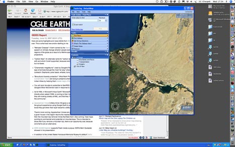
  • ESRI ArcGIS Explorer: Works fine, as long as you don’t resize the window beyond a certain limit — the graphics won’t follow you there.
  • Skyline Globe: Works fine, just as it did with Parallels Desktop 2, but that is because it isn’t turning on 3D graphics support — it uses software rendering of the globe.

All this suggests that it is not the fault of the applications — indeed, they run well when I reboot my Mac into BootCamp mode and run Windows directly. Parallels’ 3D graphics solution feels a bit hacky — and no doubt it was a difficult feat to pull off, but in this case the end result is not usable.

Best, then, to either wait for a version of Parallels that does work as intended, or else continue to run these applications after first rebooting into Bootcamp. You could always wait for VMWare to come out with their virtualization tool, and hope their 3D graphics solution is up to scratch for virtual globes.

ISDE5 Report

Here are some highlights and news tidbits from ISDE5, which is now well and truly over. This is what was new and/or startling to me:

  • “Mercator Disease”: A term coined by the Heinz Center‘s Robert Corell in his speech on climate change wherein people lack appreciation of the polar regions of the globe as a result of a lifetime spent staring at Mercator projections.
  • “Carbon fees”: An alternate name for “carbon taxes” Goldman Sachs came up with and which Corell supported, because everyone is okay with paying fees, but not taxes.
  • “Charismatic megafauna”: Used by Google’s Rebecca Moore to describe the type of animals that get the most “air play” when it comes to environmental outreach: Elephants, polar bears, whales, lions…
  • “Biocultural diversity protection”: What Mark Plotkin and the Amazon Conservation Team are trying to preserve when they empower Amazonian indian tribes by helping them create maps of their protected areas.
  • You will soon be able to subscribe to GeoRSS in Google Earth. That’s what Google’s Brian McClendon said in response to a direct question.
  • As for KML in Microsoft Virtual Earth? Microsoft’s Bill Gail did not answer “yes” directly when asked if KML is coming to their mapping app, but did say that they are looking closely at KML, and that they “realize the importance of KML in the community”.
  • Appalachian Voices‘s Mary Anne Hitt gave a very effective presentation about the group’s experience using Google Earth to publicize their cause, and the boost they got when their layer became a default layer in Google Earth.

    There’s more coming: Appalachian Voices are going to build a service that for a given house in the region returns the nearest coal-fired electricity plants, and then the mountain-top removal mines that feed them. Also coming: Heat maps pointing to commercial wind potential on mountaintops. This is intended to show that if you remove a mountain top, there is an opportunity cost, because wind farms are an alternative.

  • ESRI ArcGIS Explorer supports Flash inside a popup, ESRI’s Bern Szukalski showed in his presentation.
  • In addition to the United States Holocaust Memorial Museum’s default Darfur layer in Google Earth, and Amnesty’s web site, Microsoft’s Bill Gail announced that Microsoft had been working on a Darfur project for 8 months now, which promises realt-ime news feeds, weather and information on villages, all with GeoEye images.
  • Microsoft’s Bill Gail spent some time on the idea of connecting the exterior to the interior on a virtual globe — with as example the ability to show accurate renditions of the interiors of museums. Expect Microsoft Virtual Earth to perhaps focus more on bringing building interiors into the navigatable space.
  • Pedro Yarza from Spains AEPO demoed a cool product for visualizing the physical state of roads using Google Earth. He’s put some YouTube videos up on the session wiki where you can see this very innovative use of KML in action.
  • Andrew Fleming at the British Antarctic Survey quizzed the different virtual globe producers about the possibility of getting a better projection near the poles. Both Google Earth and Microsoft Virtual Earth currently suffer from an inability to project a layer across the poles, and the poles themselves are a nightmare.

    It turns out that GeoFusion — which is more of a core 3D tools company than a end-user virtual globe creator — uses a projection that does not suffer from these drawbacks. It’s called the Geomatrix tiling system. Here is a text description, and here is a PDF description. Better yet, the ideas behind geomatrix are free for all to use, and this fact seemed to take most people at the conference by surprise. (Precise quote by Chuck Stein: “GeoFusion doesn’t claim what we do as proprietary. We would love everyone to use our model.”)

    Hopefully all this will soon lead to some decent visualization tools near the poles. Here is a snapshot from a GeoFusion slide showing what the geomatrix tiling system looks like:

20070608031.jpg

Links: Google Earth Books, Google Earth Football, TierraWiki overhaul

Live, from Napa Valley:

  • Adena Shutzberg reports from the New York State Geospatial Summit that Google Earth CTO Michael Jones previewed a feature that links locations in Google Earth to locations in Google’s scanned books. Google Earth’s timeline functionality lets you surf through the publication date of the books, and there appears to be a clever system for avoiding clutter, reports Adena.
  • Mickey Mellen, Google Earth game pioneer with GEWar and founder of Google Earth Hacks, announces a new game: Google Earth Football:

    I’m pretty sure this is the first app for Google Earth to take custom user feedback directly from within Google Earth without using the COM API or the built-in web browser. The other game we made (GEwar, a while back) relied heavily on the browser. This game runs 100% within Google Earth. If you know of other apps that do this, please let me know.

  • Mickey has also started a new blog, Digital Earth Blog. Why?

    After coming back from Where 2.0 and the Google Developer Day, I thought I’d probably have a lot to say about a variety of earth products so I started that blog. It’ll be a lot lighter on the GE stuff than you or Frank, but hopefully covering more detail about Virtual Earth, Google Maps, World Wind, etc.

  • The Times of India manages to milk the story about New York state lawmaker Michael Gianaris calling for censorhip of Google’s satellite imagery.
  • TierraWiki gets a major overhaul. Writes Tim Park:

    The major addition with this release is that we have kicked off building a digital trail database with corresponding network links into Google Earth (and Google Maps on the site). This builds on the track statistics that we had previously had by combining GPS data from the same trail to refine the internal model of the trail and provide a range of times that it has taken different trail users to complete a trail to make planning outdoor trips easier.

    This page explains how trail info is processed, which is then accessible via a KML network link covering all trails. Here is a page showing a single trail.

Media watch: Amazonian monitoring, JFK censorship not for New Yorkers

Two articles of note in today’s media:

  • The San Francisco Chronicle reports on how Google Earth is providing indigenous people in the Amazon basin with satellite imagery to help them monitor illegal logging and mining on their reserve lands. A fascinating read.
  • New York City’s NY1 television news channel reports on New York State Assemblyman Michael Gianaris’s call to censor Google imagery in the aftermath of the foiled JFK attack plan. The report also asks 4 random New Yorkers for their reaction to Gianaris’s call, and their responses make me proud to be a New Yorker: Pretty much every reason why Gianaris’s call is a bad idea is brought up by them. Watch the video for yourself.

Links: May you virtualize buildings? Hunting for Antarctic bases

  • Do Google and Microsoft have an automtic right to virtualize real buildings? The Church of England thinks Sony certainly doesn’t. I think Sony does.
  • At the bottom of this page on the Polar View website is a KML file containing every single Antarctic base out there. It’s great for finding even the best hidden bases — some of the brand-new high resolution tiles in Google Earth that look completely devoid of human habitation actually do contain a base upon closer inspection. Happy hunting.
  • GIS pro Steve0 likes GeoCommons. GIS pro James Fee doesn’t. Lively debate ensues. My take: Neogeography is here to stay. Make room for it. Dave Bouwman puts it better.
  • In February 2007, a Sudanese gun-running plane crashed at El-Geneina airport. The Register carries a breathless story about how you can see the plane on Google Earth. The only problem? Turning on the Digital Globe metadata layer shows that the imagery of the airport was taken in February 2006.
  • Google and the JFK Bomb Plot: The Censorship Circus (Lauren Weinstein’s Blog):

    Calls for massive imagery censorship, presumably to blot out every conceivable terrorist target from the public’s online view, have a certain appeal among those who always view the Internet and most of its users with suspicion. The logical outcome of this reasoning could vastly alter Google’s imagery data storage requirements — removing enough photos to make the lords of censorship happy would reduce the Google Earth file system to something akin to a single “404 Not Found” page.

  • Cato Institute’s John Harper at the National Review (!):

    Google “Get a Life”: Ignore the roar of the JFK plotters.

    Better to concede the point: Terrorists can get the same access to payment systems, health care, shoe stores, knives, computers, photography equipment, and vitamin supplements as everyone else. Google Earth, too.

    More where that came from.

  • ESRI ArcGIS Explorer gets a blog. I’d subscribe, but it doesn’t have an RSS feed.
  • Extremely cool: Barnabu.co.uk uses SketchUp’s accurate daylight shadow feature to create a ground overlay for his dynamic London Eye that matches the position of the ferris wheel:

    london-eye-shadow-in-google-earth_small.gif

  • Only tangentially related to virtual globes, but: What glorious visualization! (Via Pruned)

Satellite imagery helping to find new Egyptian sites to dig

A LiveScience article relates how satellite imagery is being used in Egypt to find promising new sites to excavate. Egyptology Blog locates one place mentioned in the article (here it is in Google Maps) — a settlement from 400 AD on top of a much older temple dedicated to Akhenaten, the pharaoh who came up with monotheism and moved his capital to modern-day Amarna, just to the north of the site.

amarna.jpg

Turn on the National Geographic layer in Google Earth to see links to an article from 2001 about the region. And if you turn on the Google Earth Community layer — an unparalleled repository of raw geographical annotation — you’l find this link to an overlay of the region.

(I’m pretty sure that the settlement featured in the article was already discovered and excavated, so this is not a case of looking at Google’s own Digital Globe imagery and going “what, you didn’t know that was there??” But it certainly takes an archaeologist familiar with the region to know what’s been documented and what hasn’t.)

One thing is certain: These “tells” aren’t time sensitive, so the sudden abundance of cheap high resolution imagery, even if it’s 18 months old, has made satellite-based archaeological discovery much cheaper and accessible.

Previous articles in this vein:

Google helps discover Roman villa

Archaeologists dig Google Earth

Google Earth craterfest: New craters look promising

Gombe Chimp blog revamps with help from Earthwatchr

gombenew.jpg

Two related announcements of note: 1) The pioneering and Google Earth-featured Gombe Chimp Blog gets a major upgrade (including a design revamp and a change of address), and now uses 2) Earthwatchr, a new open-source geosavvy content management backend that uses Google Maps to georeference posts and which outputs content both as HTML with ready-made Google Maps and as KML.

Earthwatchr beta source code will be available July 15, 2007, according to the site. Bryce Tugwell and Nick Novitski are the people behind this. Nick blogs his involvement in the development of Earthwatchr on That Bright Instrument, highlighting some of the cool features:

If you go to the [Gombe Chimp Blog], you can see Earthwatchr integrates google maps, google earth, and your website into a single experience. Please feel free to try out the geo-referenced comment feature: Replies and comments that possess spatial information, just like the posts themselves

Bryce let me have a look at the CMS: Here’s how you georeference the post — you can even add a path:

earthwatchr.jpg

There are also options for defining the view in Google Earth. Here’s some of them:

ewperspect.jpg

Earthwatchr is written in ASP, but Bryce writes in an email:

We will be posting a forum for users to post questions suggestions and new versions, perhaps some other users will decide to jump in and start a PHP version.

There are a couple of other geosavvy CMSes out there, but Earthwatchr is the only one I am aware of that uses Google Maps in the back-end to georeference posts. I’m guessing most mainstream blog CMSes will have this feature in a couple of years. What I’m also looking forward to is GeoRSS support.

Notes on the political, social and scientific impact of networked digital maps and geospatial imagery, with a special focus on Google Earth.