Just when I thought I was in danger of becoming a jaded customer of the mass mapping space, here’s a site that effortlessly returns me to a state of slack-jawed wonder: HeyWhatsThat.
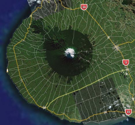
What’s that, HeyWhatsThat? it’s an automatic summit-perspective generator for any peak in the continental US. You can request the view from any mountain top, and HeyWhatsThat will use a database of summits and a DEM to show you what the view looks like from there, and annotate it for you.
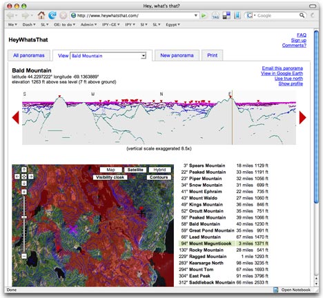
But that’s just the beginning. You can click anywhere on the horizon of the generated view to see its corresponding spot on Google Maps. Then, click on “show profile” to show the elevation of the path from the summit to that point. You can turn on a “visibility” cloak in Google Maps which paints red all those areas that are visible from your perspective. And you can also turn on contours on Google Maps.
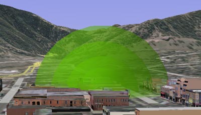
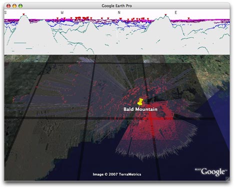
Then, click on the Google Earth link for a head trip. You get a network link showing all public panoramas. Turn one on, and you get an automatically generated overlay showing all visible areas from that summit in red, and an overlay showing the extent of your horizon. If you think this is too good to be true, as I did, just zoom on in onto the summit, and have a look around — everything is in red, just as it should be from that perspective.
If you request your own panorama, the options are very well thought out. For example, when you choose a location on the map, you get given the opportunity to move to the highest nearby spot, so that you don’t accidentally get a generated view from just below the summit. Very nice.
One of the developers, Michael Kosowsky, writes that they’re working on making HeyWhatsThat work globally. As for browser compatibility: “The web site has been developed against Mozilla Firefox 1.5 and 2.0, and seems to run reasonably well with Internet Explorer 7. Other browsers may have problems.”
if this doesn’t unleash the inner geeky-nature-lover in you, nothing will:-)