News specifically about Google Earth version 4.2:
- Bad Sky? Bad Astronomy, the alpha male of astronomy blogs, gives the Sky functionality in Google Earth a mediocre review. That’s because there are several other sky viewing applications out there today that do a better job than Google Earth currently in rendering the sky (check out Stellarium, the web-based sky-map.org and the fly-through Celestia.)
Where Google Earth/Sky shines, on the other hand, is in the annotatability of the presented data, and in the ability to let you overlay your own data via KML. Back in the early days of Google Earth, the GIS-industrial complex took a long time to understand that Google Earth prioritizes easy content creation and sharing, and that this is its main attraction. (I see that Davep’s Astronomy blog makes the same point, and additionally provides some concrete examples of how astronomers can share observation logs.)
We’ll have to do a proper comparison of all these apps in the near future, and see where the relative strengths and weaknesses are. Luckily, my first love was (and remains) astronomy, so you’re in good hands right here on Ogle Earth:-)
- Web-based Sky? Talking of sky-map.org: Google Earth is to Google Maps like Google Sky is to … ? I’ve been checking during the day whether there might not show up a web-based equivalent of Google Sky at sky.google.com, but no luck…
- Google Sky content contributors: Who were Google’s content partners in bringing the Sky to Google Earth? Google lists them here. It’s a long list with links onwards.
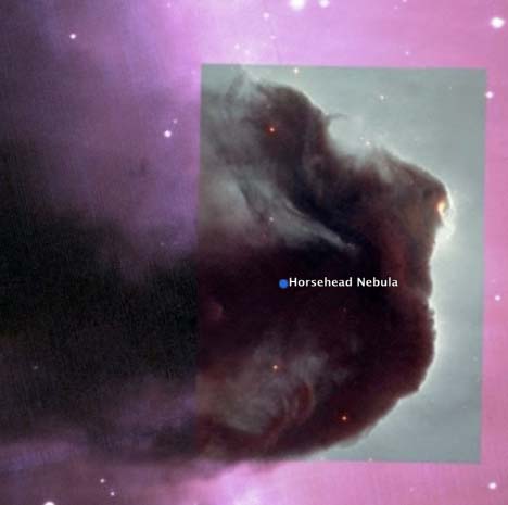
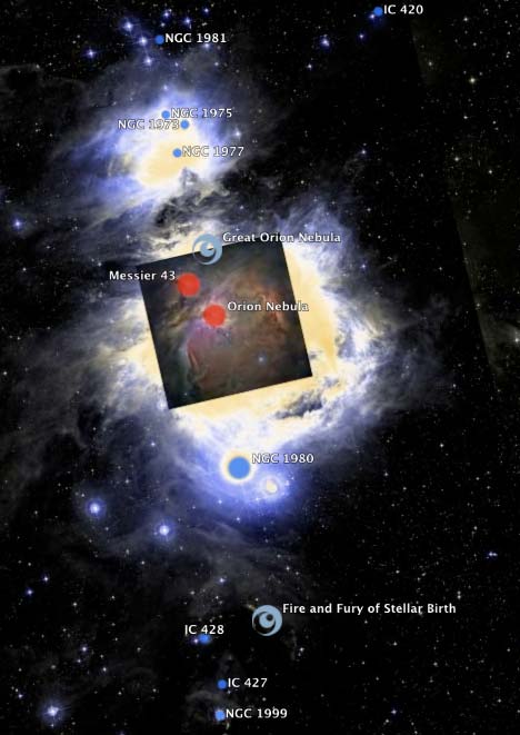
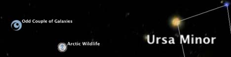
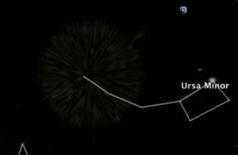
- Google Sky reference links: A resource page by Google about the Sky feature points to a new Google Earth Community forum about Sky. On it you get some interesting bug reports: Here Saturn occults Mercury! (Quite a feat:-) The resource page also sports a YouTube intro to Google Sky. Finally, here is the simple user’s guide for using Sky while here is the advanced KML reference for those who want to put sky data into KML (must-read).
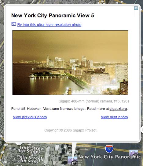
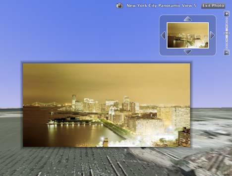
- PhotoOverlay reference links: There’s also an advanced KML guide for using the <PhotoOverlay> tag and one for setting camera angles.
News not specifically about Google Earth version 4.2:
- Embed Google Maps via WordPress: Daniel Denk of Remote Sensing Tools has created a Google Maps plug-in for WordPress that lets you quickly build a map and grab the embedding code while blogging:
While editing your post, you can quickly pop-open Google Maps from the editor and generate your map through the Maps interface, or quickly grab the link to a map you’ve already prepared in My Maps. Then, you can copy the code given for embedding and paste it directly into your editor.
Fantastic. The YouTubing of Google Maps continues apace:-)
- Google job: Google is looking for a technical writer in London. “Have you downloaded Google products and services such as Google Earth just to play around with them? If so, send us your resume!” I wonder if they would let me work out of Cairo:-)
- Unype + Facebook Unype, which previously let you turn Google Earth into a multi-user environment via Skype (for Windows), now lets you share the space with fellow Facebookers, via an app using the Facebook API.
- Cartoweb KML plugin: exportGge: “A KML export plugin released under GPL license for Cartoweb, an open source web mapping solution working on top of UMN MapServer and written in php5.”
- ArcGIS Explorer goes underground: Re ESRI ArcGIS Explorer’s latest build: It does subsurface navigation, reports Location Based Soup. (Via James Fee Blog). I wonder who’ll be first to do 3D rendering of bathymetry data…
- Geo uses for Amazon S3: Amazon Web Services Blog has an interesting post about all the webistes that are using Amazon’s scalable S3 server to serve map tiles and KML files. It mentions WeoGeo (beta), a site that I had not previously come across which calls itself “a one-stop marketplace for mapping. It supplies surveyors, engineers, cartographers, and scientists with the ability to conveniently store, search, and exchange high-resolution CAD and GIS mapping products. Mappers easily list their data for sale. Researchers quickly find the data they need.” It’s all KML savvy.
- Leica + Microsoft: Leica TITAN, a GIS filesharing and messenger service that lets you share GIS data on a virtual globe, announces that data can now be shared on Microsoft Virtual Earth 2D and 3D. Find out more here.
- Grauniad sics OS: Missed this before: The Guardian covers the story of the UK Ordnance Survey nixing the licensing of data that would have made a 3D model of London in Google Earth possible.


 ]
]
 Esna, on the Nile.
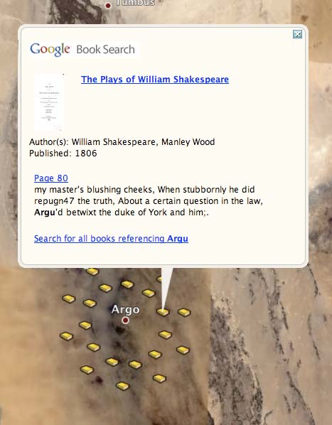 Argo, on the Nile