Usage notes for Google Earth Mac 3.1.0527 Beta

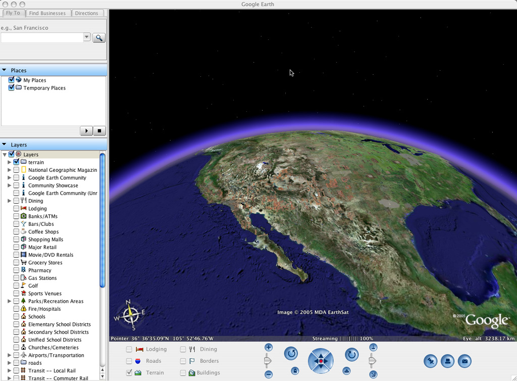
The Mac version of the best free software released this side of the millenium is now out, just a little over six months after it was first released for free on Windows. First impressions are that Google Earth Mac is a very solid beta. There are a few features pared from the Windows version, but none that dent the enjoyment or its usability. And I think the Mac version looks better than the Windows version, with the bright “Googley” colors on the panels replaced by a much cooler light blue (official screenshot).

blueish.jpg

Who is it for?

Amazingly, minimum specs are listed as a 600Mhz G3 with 128MB RAM and 16MB of VRAM, though you need OS X 10.4. (Can OS X 10.4 even run on 128MB RAM?). Google promises (in the release notes) that future versions will run on 10.3.9. Recommended specs are a G4 at 1.2Ghz or faster with 512MB RAM and 32MB VRAM.

So, what works?

I’ve thrown all manner of KML files at it, including some of the biggest baddest ones I could find, as well as large overlays, complex network links and 3D models, and they all work flawlessly (with one exception).

Google’s own 3D-buildings layer renders fine; you can email placemarks and images, use the measuring tool, contribute to Google Earth Community, do location searches and get playable directions, just as with the Windows version. All the layers you find in the Layers panel in the Windows version are available on the Mac version as well, including those from National Geographic.

What’s not included?

There is no embedded browser option. Instead, links lead to your default external browser. Google says (in the release notes) that browser integration is on its way. (BTW, Firefox is smart enough to open KML and KMZ files automatically in Google Earth, while Safari is not.)

GPS, Path, and Polygon are not available in the menus, because these are Plus and Pro features, and those versions are not available yet. Google says, however, (yes, in those rather helpful release notes) that Plus and Pro versions are on their way.

The other things that currently aren’t possible but which Google says soon will be are full-screen mode and the ability to use Gmail to send pics and placemarks instead of your default mail client.

Preferences

In the preferences panel, virtually all preferences are exactly replicated from the Windows version. (One exception is that you can’t choose your display fonts on the Mac version.)

With those exceptions noted, the Mac and PC versions are feature identical.

Further observations

In the Search panel, what’s called “Local Search” on the Windows version becomes “Find businesses.”

There are a few cosmetic glitches I noticed, but no showstoppers, and they’re listed in the release notes. These notes also offer workarounds for older graphics cards, and offer tips on setting your ideal cache size.

For geeks

There is no Applescript support yet, though I’m told it is something that is being worked on (and the application does list itself as Apple scriptable, though there is no AppleScript dictionary when you go looking.)

This version is not a universal binary, but it runs on Rosetta (albeit slowly, I am told). There is a universal binary version in the works.

This application was developed on Qt, the cross-platform development platform (as first noted here). I assume this means the Linux version is not too far behind.

Google Earth for Mac will obviously not play nice with web applications that require Microsoft’s ActiveX or which hack the Windows application for scriptability, so no GlobeGlider for the Mac.

The only way I’ve gotten Google Earth Mac to crash is by having it try to access a password-protected KML file, just like the one Jason Birch posted in his comment on a recent Ogle Earth article about whether you can password-protect KML files. I suspect it’s because the Mac version doesn’t have a built-in browser yet.

wonky.pngAnd finally, a pet peeve: This wonky button.

[Update: 21:17 UTC: The release notes and the Google Earth download site differ somewhat in the recommendation for what is the minimum spec. On the site FAQ, “500Mhz” (I presume from a G4) and 256MB RAM are considered a minimum for the Mac.]

Google Earth out of beta (!)

The official Google blog explains why the Google Earth site lost its “beta” sign a few minutes ago:

Our eldest, Google Earth for the PC, is officially leaving beta status today, and we couldn’t be more pleased. For those of you who downloaded early, upgrade to the latest and discover Google Earth all over again.

[Update 21.27 UTC: Frank notes on Google Earth Blog that the current version for the PC released November 18, version 3.0.0762, has been rechristened as the first non-beta.]

Garmin announces GPS product support for Macs

Mac users have always had slim pickings when it comes to GPS devices and drivers.  That will soon change because the highest profile GPS device maker, Garmin, has just announced it is going to start supporting Macs across its line of GPS devices and applications. Here is the press release. Some highlights:

Beginning in spring 2006, Garmin will offer a Mac version of its popular Training Center software. Used with Garmin’s line of Forerunner and Edge series of fitness products, the Training Center software lets users plan and analyze workouts. […] Also in spring 2006, Garmin will make the Motionbased.com upload interface Mac compatible. […] By the end of 2006, Garmin intends to have made all its popular hardware and software applications Mac OS X compatible.

[Update 2006-01-11: In the rush to report on Google news yesterday, I forgot to add the punchline to this post. Motionbased and Garmin’s other products support Google Earth, so this means that Mac users will be able to benefit from both Garmin and Google’s efforts to bring GPS to the Mac.]

Geoblogger goes to Yahoo!

Well well well, Rev Dan Catt, of Geobloggers renown, just got a job at Yahoo!, joining Tom Coates and Simon Willison, and no doubt plenty of Web 2.0 goodness will come of it.

Dan writes, “I’ll also post how this affects/has affected geobloggers and what the plans are.” Yahoo! now owns Flickr, remember. Does this mean that Dan’s been persuaded to switch mapping API for the next version of Geobloggers? It’d be difficult when Yahoo! Maps is US only. As long as there is still a Google Earth network link in the mix, I’m completely agnostic on the matter:-)

[Update 2006-01-10: Dan explains (nearly) all.]

Into Google Earth, one county at a time

nwark.png

The Northwest Arkansas Times tells the story of how it came to be that two remote counties in norhwestern Arkansas have some of highest resolution imagery in Google Earth:

Once the [aerial mapping] project was completed, the University of Arkansas Center for Advanced Spatial Technology (CAST) took the information and put in on a server application called Geostore. In order to get the data, interested people had to download the file and have the software that reads it. “Google Earth is always looking for the latest imagery so they contacted the CAST and asked for permission to put it on their Web site,” he said. “Now anyone can access the data from any location.”

How refreshing to see a (local) government decide that since the information was gained via public money, it belongs to the public. I wish that were the norm. Read the whole article.

[Update 17.423 UTC. Adena at All Points Blog wonders, why aren’t public bodies taking over the role of keepers of such data? This raises interesting questions about trust and the role of government. Would you prefer it that a private company makes satellite imagery of your area publicly available, but only if it sees economic incentives, or that the government is responsible for doing so? With a private company, privacy issues loom, whereas with the government, censorship issues loom. Of course, governments can make laws that protect consumers from companies, while private companies can always access foreign source data that governments can’t censor. So the result is an equilibrium of sorts.]

Can Google Earth access secure sites?

A reader wrote asking if I knew of a business example where somebody provides restricted KML files to Google Earth, i.e. which require a user ID and password to download (the idea being that you could then sell them). That’s not possible, as far as I know and the reason is that Google Earth does not currently have the ability to ask for user IDs and passwords before accessing a restricted server. (I could be wrong, in which case please set me straight.) [I am wrong. it works fine. See comments, and I have word from the Google Earth team as well. (20:30 UTC)]

It is not an outlandish feature request, though; the nearest analogy is RSS, and RSS readers are definitely able to ask for passwords, and there are restricted RSS feeds that require it.

In the meantime, vendors could keep network link files they want to sell on a restricted server that you use an HTML browser to access; these then get downloaded and opened in Google Earth, getting their data from normal, non-restriced servers. Of course, people who download a password-protected network link would be able to just distribute it at will, but you can do the same thing with passwords for normal content. The trick, then, becomes making sure the network link refreshes from a URL that has unique ID linked to an account. If an account starts getting hit from many different IP addresses simultaneously, you could call it abuse and cut it off.

Regarding business models and Google Earth, the only ones I’ve seen so far are referral-based (use our Google Earth network link to find a hotel/house/holiday and we get some money), services-based (let us build you your Google Earth-based web app), as advertising (Google Earth is impressive, so is our product/city) and tangentially, as content producers (3D models that could be viewed in 3D renderers, including Google Earth). but I haven’t yet seen anyone deliver value through Google Earth for an up-front fee. One of the easiest Google Earth-based applications to monetize in this way right now, in my opinion, would be a game, like GEWar.

[Update 12:38 UTC: I soon as I posted, I thought of an example! Geocaching.com makes its geocaching database available in Google Earth for premium members only. It’s one feature among many you get for $3 a month.]