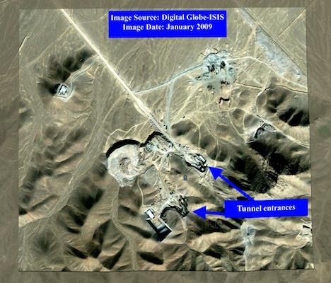
During the North American day yesterday ISIS chimed in with its best guess (PDF) for where Iran’s newly declared underground nuclear fuel enrichment plant is situated — two guesses, in fact.
One of them is the same as the location identified in the previous post here on Ogle Earth as a likely candidate for the site. But ISIS also identifies another possible location further to the east.
ISIS has the benefit of very recent imagery it commissioned, taken by DigitalGlobe — August 2009 for the already-identified candidate, and January 2009 for the new candidate. The new candidate in particular shows much development work in the intervening four years between when the base imagery in Google Earth was taken and the DigitalGlobe imagery acquired in 2009.
2009:
2005:
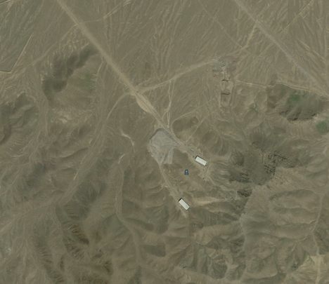
The other candidate, to the west, shows little outward change in the intervening four years. Based on the 2009 imagery, my inexpert opinion now favors the new candidate identified by ISIS.
ISIS’s findings are in PDF format, so I took the images therein and positioned them as overlays in Google Earth. Here they are available as a KMZ download. Play with the opacity slider in the sidebar to switch between 2009 and 2005.
[Update 18:01 UTC 2009-09-28: ISIS has now also published a brand new image of the site pictured above, commissioned from GeoEye on September 26 2009. The KMZ file linked to above has been updated to include this second image. The resolution is a bit lower than the DigitalGlobe image taken in January 2009, but there is clear progress visible in the construction site during the intervening 8 months — both tunnel entrances are now being covered up with earth. I suspect intelligence services are right now trying to calculate the volume of the excavated mound right in front of the tunnels as a way of estimating the minimum size of the excavated space inside the mountain.]
[Update 11:42 UTC 2009-09-29: KMZ file is now updated with two closeups from the Sept 26 GeoEye image, via this CNET article, attributing IHS Jane’s analysis.]
[Update 2009-09-39: New post: Qum nuclear site redux: Original-resolution images now published to Google Earth]
(Note: Because the imagery is of hilly terrain and taken from a different position in the sky, it is not perfectly alignable with the base imagery.)