Via Vincent Brown’s always-relevant archaeological Twitter alerts I learned about what is being termed one of Britain’s most exciting archaeological find in years: Two 6000 year-old tombs have been discovered not far from Stonehenge, near the village of Damerham.
So far, only the local media has the scoop. From the June 4 article in the Southern Daily Echo we learn that:
The tombs were discovered after staff from English Heritage studied aerial photographs of farmland in the Damerham area and saw signs of buried archaeological sites.
There’s even more info in the June 5 article:
The tombs, thought to be among the oldest ever found in the UK, are already helping to reveal how we may have worked the land — more than a thousand years before even Stonehenge was heaved into place.
If aerial photos helped flag the plot for further research, what might Google Earth show? Is there enough information online to find the exact location of the tombs? It proved to be a challenge impossible to resist.
Googling “Damerham” led me to the village’s wikipedia page (!), which in turn led me to the Damerham Archaeology Project website, which turns out to be the very same project being reported on in the Southern Daily Echo.
The project website seems to have been last updated during the 2008 summer season, before the import of the find became clear. But it does sport the aerial imagery that first alerted the archaeologists to the location, so it was just a matter of matching the view in the image with that in Google Earth.
It didn’t take long. Damerham is a small village, and field shapes in the area are distinctive, so finding the exact location was easy. I’ve marked the spots in this KML file.
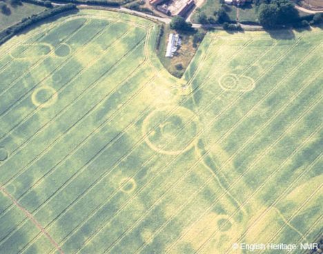
Aerial shot (from the Damerham Archaeology Project):
Google Earth view:
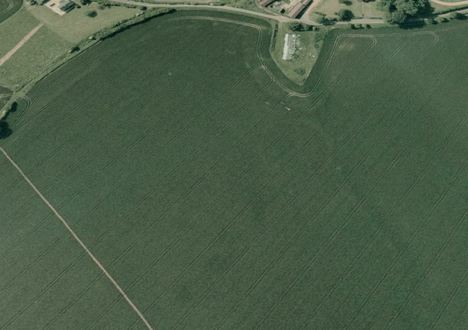
It is interesting to compare the aerial photos on the website to those in Google Earth. Clearly, the aerial photo was taken in a season when the fields show off the cropmarks at their fullest. The current Google Earth view shows off one circle pretty clearly, and hints at the oblong mound flanked by two ditches referred to on the website.
But turn on the historical timeline, and you get more imagery of the fields. Strangely, the current view in Google Earth of the fields is not the most recent — it’s from 2002, or even 2000 (as those two years clearly use the same source imagery). But move to the imagery taken during 2005 and you’ll find a much clearer view: The mound and ditches are clearly there, and there is another circular cropmark visible near the big one, as this false-color version makes clear (lower right):
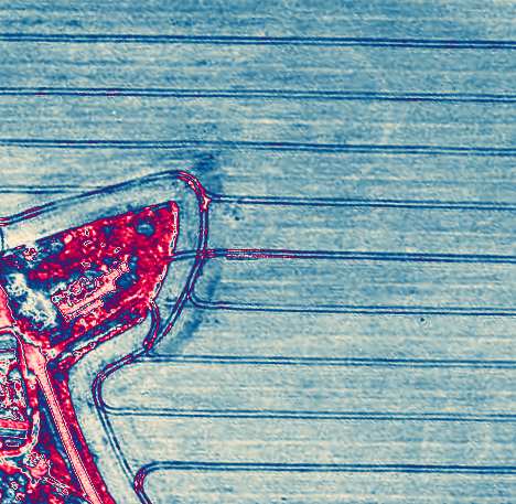
The other features, however, are fully hidden by the crops. Clearly, there is an advantage to commissioning your own aerial imagery intead of relying on Google Earth:-)
Oh my, crop circles!