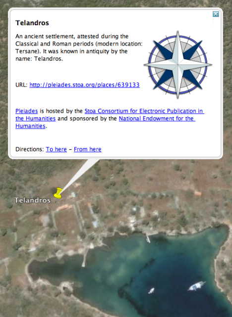
Pleiades “is an international research community, devoted to the study of ancient geography.” All the objects in its fast-growing database are referenced as GeoRSS and KML. Import Cartography‘s Sean Gillies is Pleiades chief engineer, and he has been busy stuffing the database. In high-resolution areas, placemarks often do correspond to interesting features on the ground:
There’s hours of hunting here for ancient world buffs, and especially so if you live in the area:-) Given that these placemarks have time-based period data for when they were inhabited or relevant, it would be great to eventually be able to integrate these into the Google Earth time browser via KML’s <TimeSpan> tag, so you could surf through history, seeing places appear and disappear as civilizations rise and fall.
I’m sorry that we don’t have anything in the Cairo area yet. We’re complementing like-minded archaeological projects as we roll this stuff out. The new batch is related to activities at Cyrene, and next up is places around ancient Londinium to provide some context for the Celtic Coin Index. I definitely agree about the time slider. After FOSS4G and a visit to the NEH, we’ll get to work on that.