Sorry about the cheesy headline, but when a mining company decides to publicize a gold find by putting all the relevant GIS data into Google Earth, that’s what you do.
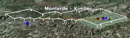
Kimber Resources is a gold and silver mining company in the Mexican Sierra Madre, and drill results on their Monterde property have indeed returned gold. (Witness the hike in their share price today). Here is the page with screenshots and the KMZ link, and here are some I made myself:
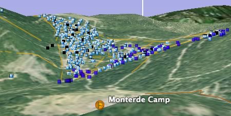
Click on individual icons to get drill results for that spot. Now, you no longer need to rely on the company’s own conclusions about the viability of a site — make up your own mind from the raw data.
Previously, Brian Timoney has helped companies visualize their geospatial data in Google Earth, notably with Jonah Gas. Kimber’s efforts are very much in the same vein (terrible pun intended). Do two instances make a trend in corporate communications? My guess is that soon, companies which don’t offer this level of granularity in their data to investors are going to be penalized for their opacity to the market.
This is a great idea to raise the profile of the company.