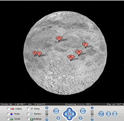
 Two weeks ago, I posted a layer to Google Earth Community made from Google Moon. The layer was a low-resolution proof of concept, but I remember reading somewhere that Google had resorted to the cheese close-up because higher-resolution images of the moon were not available to them.
Yesterday in a post to the above thread, Jim Volp, operations engineer at ESA for the Smart-1 lunar orbiter, pointed us in the right direction: To a series of extremely high-resolution lunar maps available from USGS. Just keep on doubling the area for some amazing pictures; then imagine them as a layer on Google Earth. Anybody willing to do the work? (My Google Earth is unforunately in a Virtual PC on my Mac here at home, and not conducive to positioning layers of any bulk.)
Perhaps Google themselves might be persuaded to replace the cheese with some new content from this trove. Best of all would be a proper Google Moon, with altitude information, served via a Google Earth-like application, though what monetizing opportunities that could possibly hold is beyond me. (I might be up for buying the content, actually. Or perhaps Google Moon could become a kind of mirrorworld sci-fi settler MMORPG!)
It lets you download up to about 2 kilometers per pixel for the whole moon. You can probably get more for small parts. Anyway, nobody can download a 2 GB file. I don’t know how to post the overlay.
there is also a shaded-relief thing that is 1 kilo per pixel, and its 19 megabytes. I have an overlay, but dont know how to post it on the main google earth forum