It’s time for our quarterly pilgrimage to the Google Earth site to suckle at the download servers where a brand new version of Google Earth awaits for our edification: Google Earth 4.2 (beta).
I’ve just been playing a bit with 4.2, looking for new features:
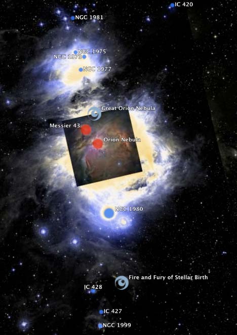
Gigapxl photo layer: in the layers sidebar, a new item under Featured Content: Gigapixel photos from the Gigapxl Project:
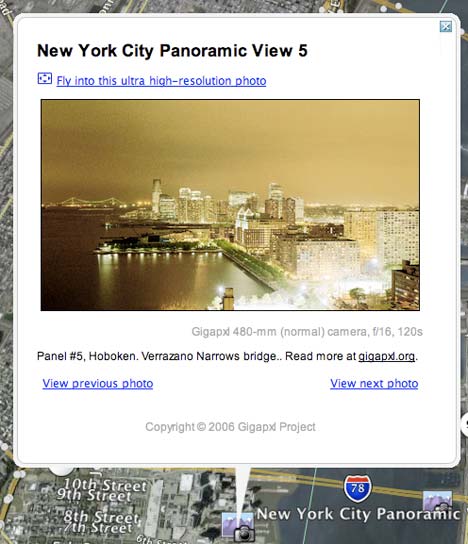
It should be no real surprise that those photos have made their way into Google Earth, as Google Earth CTO Michael Jones is an avid gigapixelator. One thing to notice on the above popup is that there are links to other placemarks. Yes, indeed, that’s because Google Earth 4.2 has…
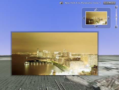
Support for KML 2.2: Time to go reread the KML 2.2 reference. You can now link from one placemark to another inside a KML file, including already loaded KML. Another thing the Gigapxl photo layer takes advantage of is the <PhotoOverlay> tag, which lets you orient a photo and the position of the viewer (among other things.) (The Gigapxl layer also comes with some new tools for zooming in on the photo itself, shown above — though I don’t think that’s part of KML 2.2.)
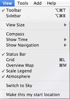
Google Sky: The most impressive and surprising new feature is also the one I almost missed: Can you find it?
![]()
Switch to Google Sky and you get the view from Earth of the Sky, using the same technique as Earth but inverted, so that you are staring from the center of a globe, and able to zoom in on a progressively higher resolution starscape. Or as Dave Bowman would say it, “My God, it’s full of stars!”
It’s all annotated too. Here’s what you can turn on in the suddenly morphed Layers sidepane:

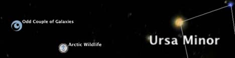
It’s so new that it’s not without a few quirks: If you have some Earth-based placemarks turned on and switch to sky, you get this:
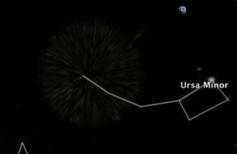
And the same goes for the Earth-based scale legend, which continues to show kilometers/miles. Also, there is no North Star, as the projection system suffers from the same problem we see at the poles on Earth:
But who’s quibbling? This is a wonderful new use of the Keyhole architecture.
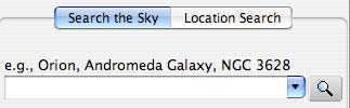
If anyone wonders why Google might want to do this: I think the answer lies in the new search pane:
Google’s mission is no longer to organize the world’s information, but the universe’s. Vint Cerf’s talk at GeoWeb a few weeks ago now takes on a whole new salience. (He cautioned against developing a too Earth-centric internet.)
PS: We’re now going to have to start comparing Google Earth-Sky to other astronomy tools out there. Will Google shake up the astronomy field like it has GIS? We’ll have to wait for the official announcement to find out what the source of the high resolution sky imagery is.
(For the geeks: It’s now Google Earth 4.2.0180.1134 (beta) for Mac and Windows, and also Linux, Built on August 20, 2007)
[Update 10:12 UTC: The BBC has the scoop (Via Mapperz), interviewing Google’s Ed Parsons, who fills us in on some of the details:
“Click a button and the world flips round and you see the sky from that particular location,” explained Mr Parsons. “[The view] would be the constellations that you would see oriented in the sky on that particular day at that particular time.”
And the BBC writes:
Imagery for the system came from six research institutions including the Digital Sky Survey Consortium, the Palomar Observatory in California and the United Kingdom Astronomy Technology Centre.
Now Google Lat Long Blog also carries the announcement of what it calls “Sky in Google Earth” (not “Google Sky”, as the BBC calls it, which I suspect is what people will call it anyway.)]
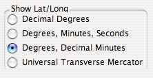
[Edit: I got rid of the UTM mention i the original version of this post. That wasn’t new; my mistake. What is new is another option in the preferences pane: The ability to see coordinates as degrees with decimal minutes:
 ]
]
[Update 10:31 UTC: Astronomer Alberto Conti blogs about the genesis of Google Sky:
A few days later, I attended a National Virtual Observatory meeting together with Carol Christian. At the meeting we showed a KML that had been originally developed by STScI’s Frank Summers. Frank had taken the Hubble Press Releases and used the KML GroundOverlay structure to display them in Google Earth. It was the beginning of the realization that KML was versatile and that the Google GUI was malleable enough to be adapted to sky data! […]
At the meeting we met three people that were going to be the Google team that really made it all happen: Andrew Connolly, Ryan Scranton and Simon Krughoff. All three of them are astronomers, but they soon would become interns at Google and start working on GoogleSky.
I also see Alberto took the domain name oglesky.com for his blog. Fair enough. As long as nobody think’s we’re related:-)]
[Update 11:04 UTC: Reuters also has the story, and so does the New York Times.]
[Update 11:50: As Mapperz discovered, if you read the KML 2.2 reference, you’ll see that there is now mention of Flash support in Google Earth 4.2, so that you can embed YouTube videos. I haven’t been able to get this to work on my Mac with the latest Flash player installed. Has anyone else had any luck? This is a major and long-standing feature request, so it will be great to get this to work.]
Thanks for the info. I wish they would write what version number is available for download on their site.
Excellent Roundup, KML 2.2 is good benchmark and soon be a possible OGC standard. The Google Earth/Sky is good and unique extension. Keeping the functionality of what users feel comfortable with and expanding their horizons…
Mapperz
http://mapperz.blogspot.com/
>I wish they would write what version number is available for download on their site.
*I* wish their installer didn’t insist on installing on my (full) C: drive :-(
About YouTube embed videos in GE, on my Windows XP SP2 works fine. A great feature!
Great addition to GE. I hear the sucking sound of more time being wasted looking at the universe. :)
KoS
THe North Star does appear in the data set. Polaris is the North Star despite not quite being directly over the north (it is about 42 minutes away from exact north).
To find Polaris, you used to have to follow the two stars forming the non-handle end of the saucepan shape in Ursa Major and follow the line they make north – the first bright star you reach will be Polaris. Now of course, just type it into Google…
RNH: Google Earth installs to the location of the default Windows install dir, which is shown as an environment variable called %Program Files% in a DOS shell. You can edit a registry setting to reconfigure this:
http://www.annoyances.org/exec/forum/winxp/t1064354913
Because there are side-effects (as noted in the article) you might want to change it temporarily, install GE, and then put it back.
Obligatory promo: Our latest VNS/WCS Scene Express (in VNS 2.85) supports the new KML 2.2 camera model. which is much better at representing arbitrary viewpoints. Now if they’d just include camera FOV in the Camera node, and provide for storage of animated camera paths.
I am a director of SKY-MAP.ORG. Go to http://www.sky-map.org and you will see that what Google has just announced already exists in web-based version for about a year. We have SDSS, IRAS, and H-Alpha surveys integrated in our system and we have 100s of millions of objects mapped. Only for HDF we have > 10.000 galaxies mapped. We also have articles related to hundreds of thousands of objects and many features that Google doesn’t have. We would be happy to find a way to cooperate with Google.
Here are some links:
Hubble Ultra Deep Field: http://www.sky-map.org/?img_source=IMG_all&zoom=13&object=udf
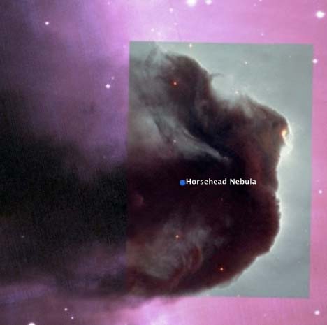
Horsehead Nebula: http://www.sky-map.org/?object=Horsehead Nebula&zoom=9&img_source=IMG_all&img_borders=1
M45, The Pleiades: http://www.sky-map.org/?img_source=IMG_all&zoom=7&ra=3.772&de=23.948&img_borders=1
Thanks,
K. Lysenko,
SKY-MAP.ORG,
kostya@sky-map.info,
416-8369785.
There is a very annoying (and old) bug in GE that still hasn’t been fixed. The ruler tool always defaults to miles, regardless of the settings in Tools->Options. Feet and miles are obsolete units. Their use should be banned. Grrr
Why has Google Earth Maps gonbe back in time – I have now witnessed a regression over at least three map sets to images that must be 10 years old or so.
Why not the latest images?
I am building a website for an astronomical group and wish to put Google Sky on the site for them to look at or download. Is this possable? If the answer is yes, the next question would be how?
All the best
Anthony
This is a fantastic idea, but in some places the execution currently is, IMO, rather ugly. The most objectionable feature to me is the supersaturated and darkened false-colors on the stars. The image of the Pleiades or any other open cluster are good examples. I hope in future for a more lifelike depiction of these objects and the stars in general can be added, because this makes for an unbeatable teaching tool.
While we are not related, I parked the domain since it would be great if we could collaborate.. :-P
I recently downloaded the new google earth. It is a little overwhelming at first, but you get use to it. Well while looking at the millions of stars and galaxies, my friend and I found several weird lights in the sky. They are quite strange, and i urge you to check them out. http://bluebeamsingooglesky.blogspot.com
I want to download google earth 4.2,but my country Sudan is not in the available list.What could I do?
THe North Star does appear in the data set. Polaris is the North Star despite not quite being directly over the north (it is about 42 minutes away from exact north).thanks for adding the KML file