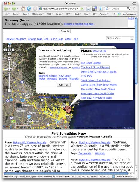
There is a new geotagging site on the block. Right from the get-go, Geonomy sports over 400,000 georeferenced locations — wikipedia articles, National Geospatial Intelligence Agency data, user-added content, geographic features — all of it searchable, viewable in Google Maps, and browsable by category and tag. Add to this USGS topo maps and US weather as overlays in Google maps. The pièce de resistance, however: Each category and tag has its own KML link for instant viewing in Google Earth. I just wish they’d be dynamic network links.
The site is the work of Ben Lewis and Scott Melby. Here’s how they explain what they’re doing:
Geonomy does not aim to be a warehouse of map information but rather an index to place descriptions which already exist on the web. Geonomy does aim to help expand the list of existing descriptions, improve the geographic locations of existing features, and to help improvements make it back into Wikipedia and other repositories.
That makes Geonomy more like Wikimapia and Geonames.org than Tagzania. One thing is for sure: The bestiary of georeferencing sites sure has grown this past year to contain some very varied specimens.
If you’re curious for more, Scott Melby is interviewed about Geonomy over on Profy. Interestingly, Scott also runs a wine blog — now georeferenced, of course. (Via The Blog Herald)
Although Geonomy does not yet support dynamic network links for Google Earth, it does allow you to view up to 500 places from a full text search or tag query… just click the “View in Google Earth” link in the control window on the right side of the map while viewing the results of one of these queries. Check the Geonomy wiki for other usability tips.
-gs